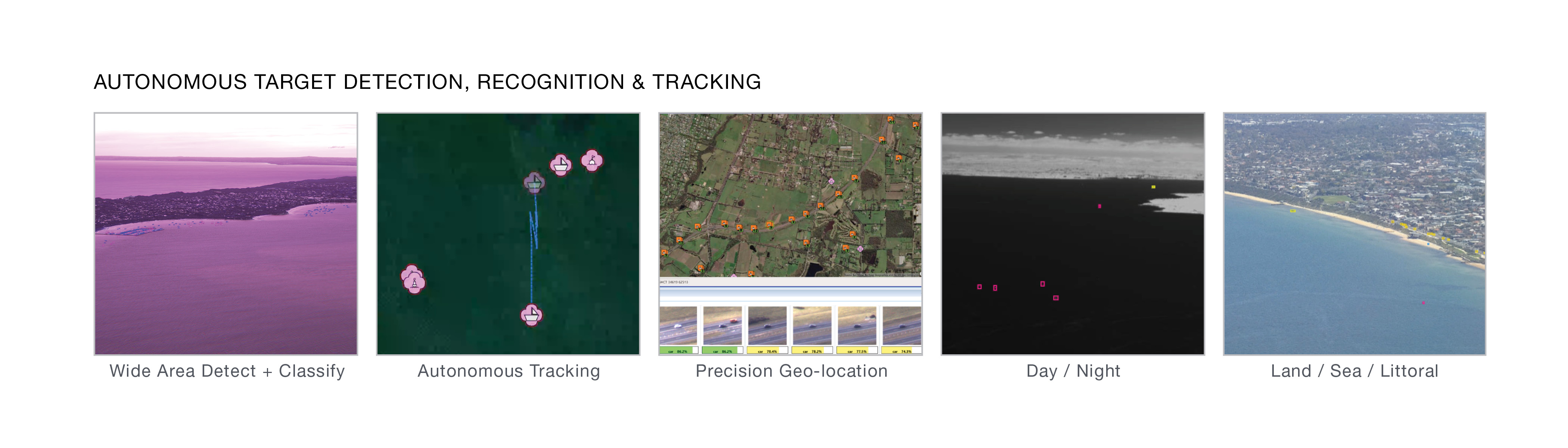
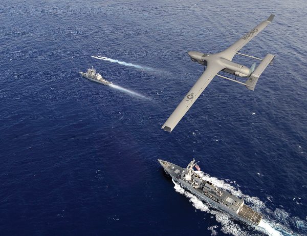
The world’s first real-time, area scan, hyperspectral sensor that provides complete domain awareness in all conditions and environments, both day and night. Artificial Intelligence operating on the edge autonomously detects, recognizes, locates and tracks all objects, providing on-demand situational awareness.
Wide-Area Detect & Classify
Operates in land, riverine, estuarine, littoral, coastal and open-ocean environments.
AI Operating on the Edge
Real-time detection, recognition and tracking of all objects using onboard AI orchestration and data fusion engine, even through obscurants and whitecaps.
Autonomous Tracking
Completely autonomous spectral signature target identification – no need to process target data for false positives
Belgian Defence: The Integrator: Sustained Aerial Reconnaissance as Operational Added Value
The strength of the Integrator lies not only in the platform itself, but in the way it generates, processes, and disseminates information within an operational context.
Insitu Awarded $8.6 Million Services Contract by Canada Armed Forces to Support Long-Endurance CU-172 (Integrator) UAS Fleet
Insitu, a Boeing Company, has been awarded an $8.6 million firm fixed-price services contract by Canada’s Department of National Defense to support the Canada Armed Forces’ fleet of long-endurance CU-172 Uncrewed Aerial Systems (UAS).
Offering VTOL, SATCOM, and advancing resilience capabilities
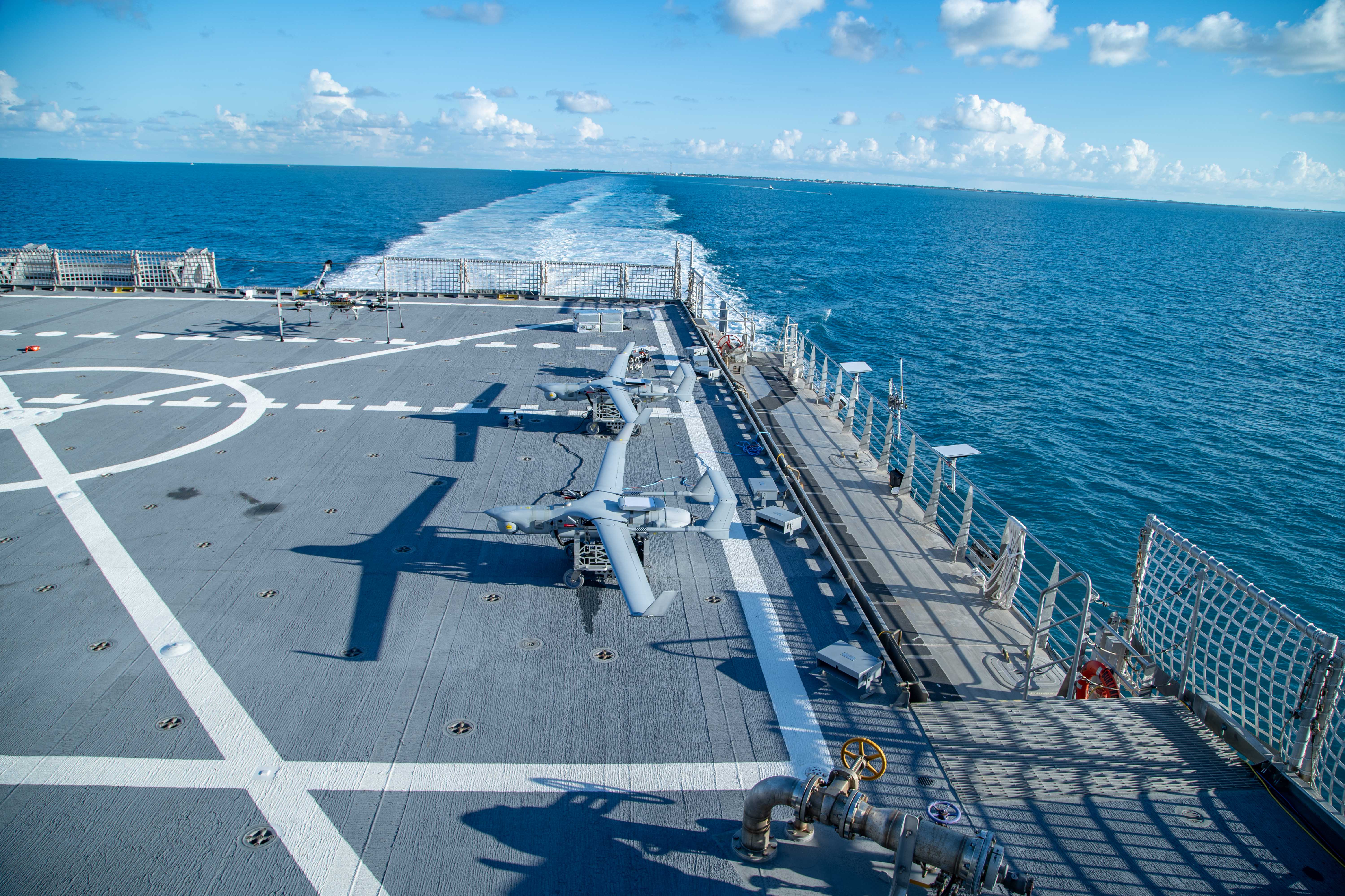
With over 1.6 million combat flight hours, ScanEagle is the industry’s most trusted long-endurance UAS. Electronic resilience features, SATCOM, VTOL, AI-enabled payloads, and the same best-in class endurance make today’s updated ScanEagle ready for the battlespace of tomorrow.
Long-Endurance
ScanEagle’s 18+ hours of endurance carrying 17 lbs of Insitu best-in-class payloads means you’ll never lose sight of what’s most important. PLEO SATCOM enables enhanced over-the-horizon ops.
Launch Anywhere
ScanEagle is available with both traditional rail launch/Skyhook and FLARES Vertical Take-off and Landing kit. VTOL requires minimal deck space and zero aircraft modifications. Ready to launch within 30 minutes with only 2 operators.
Resilient Autonomy
ScanEagle has been operating in GPS-contested and denied environments since 2018. Alt-nav, resilient datalinks, and other advanced resilience features onboard.
Engine: Heavy fuel (JP-5 or JP 8) or C-10 gasoline engine
SATCOM C2
Proliferated Low-Earth Orbit Constellations SATCOM available
Sensor and Data Options
Electro-optical (EO) camera and telescope
Medium-wave infrared and EO for day-to-night operations
AI-assisted wide-area maritime search
Synthetic Aperture Radar (SAR): MMTI/GMTI, CCD
Laser range finder, laser pointer, and laser designator options
Electronic warfare / SIGINT / comms relay
AIS: Maritime vessel identification
Visual-Based Navigation
Detect and Advise
Video Datalink: Analog, digital encrypted
C2 Datalink: Encrypted, unencrypted
FLARES Specifications
Weight
Max ScanEagle weight 62 lb (28 kg)
Temperature Range
-20º to +45º C
Wind Range
0-30 knots
10 knot gusts
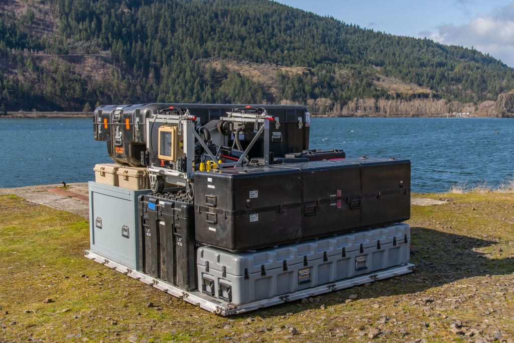
Full Mission Set Packout
463L pallet: 108 x 88 x 62 in (2.74 x 2.24 x 1.57 m)
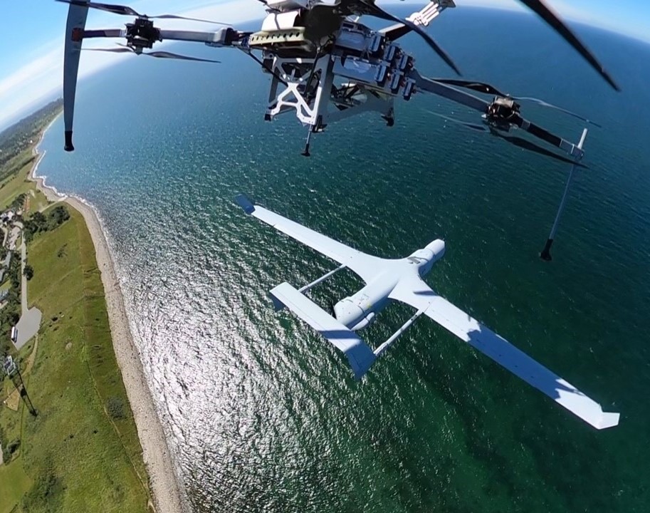
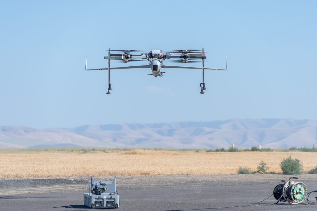
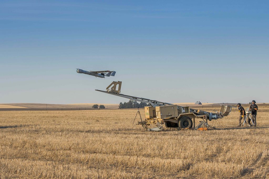
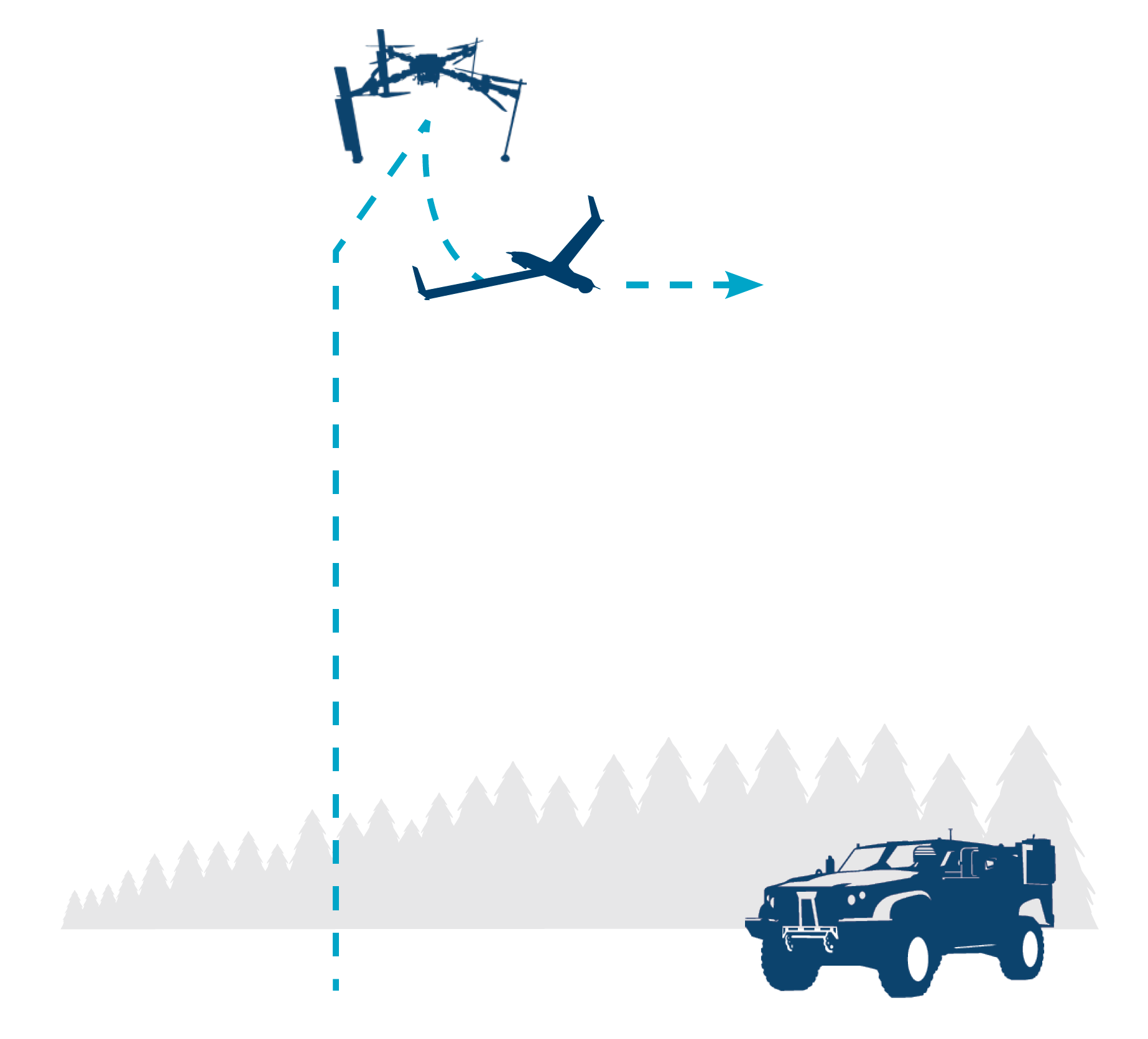
How does ScanEagle with VTOL work?
LAUNCH
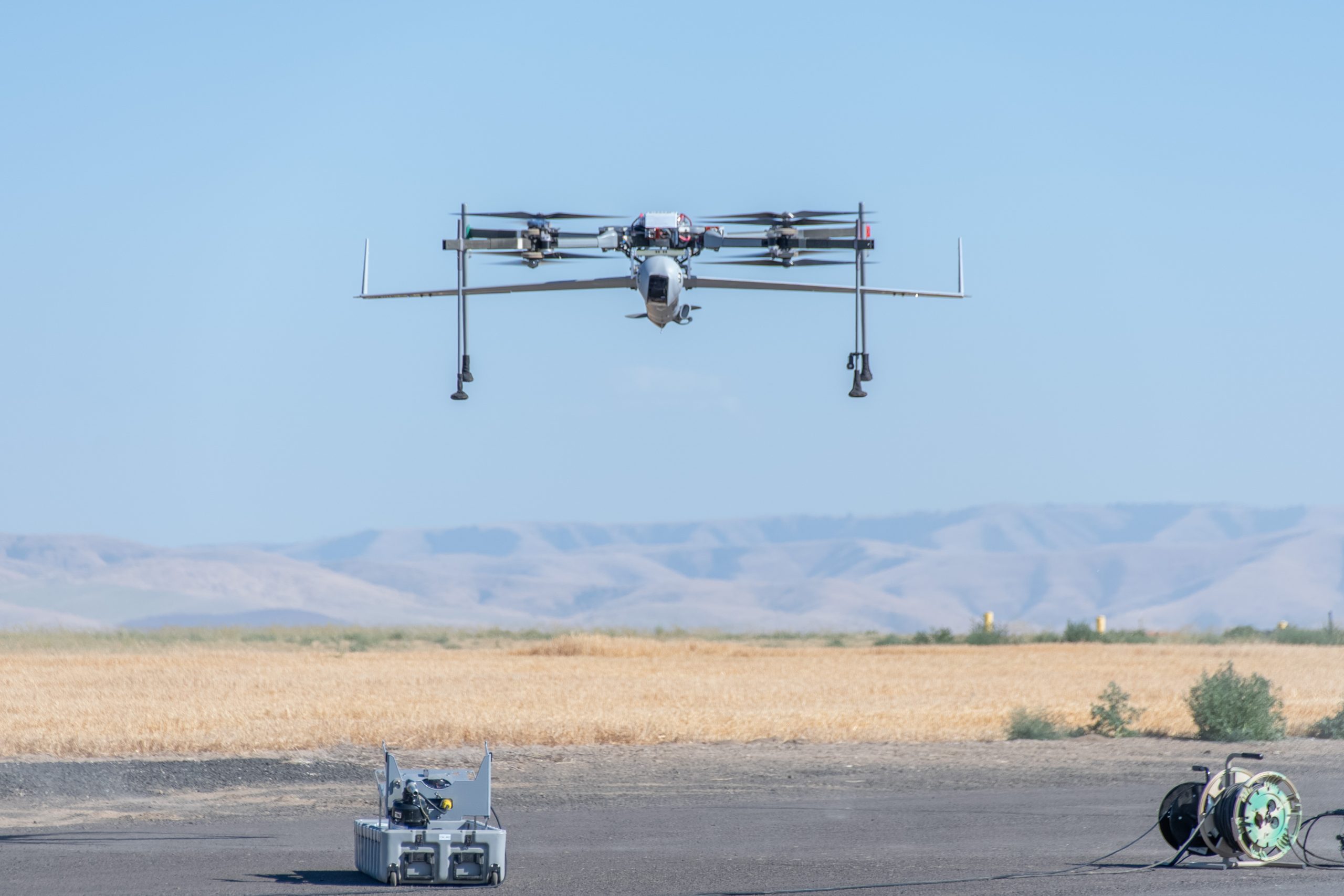
FLARES mated with ScanEagle climbs vertically to altitude (500′ AGL), dashes into the wind, and releases ScanEagle into fixed-wing flight (<5 minutes).
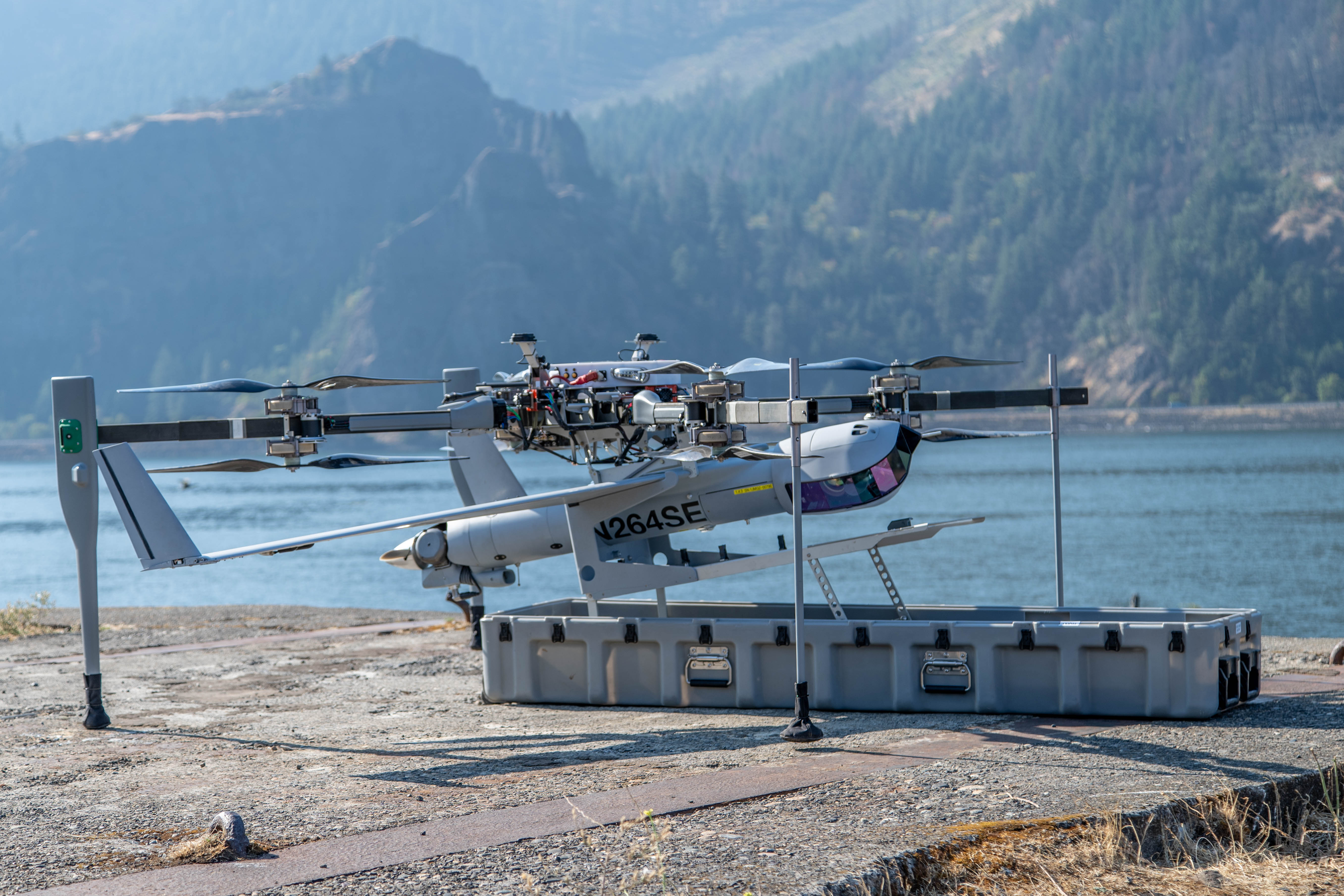
FLARES returns to land/ship launch point
In case of an aborted launch, FLARES returns and lands vertically with ScanEagle still attached.
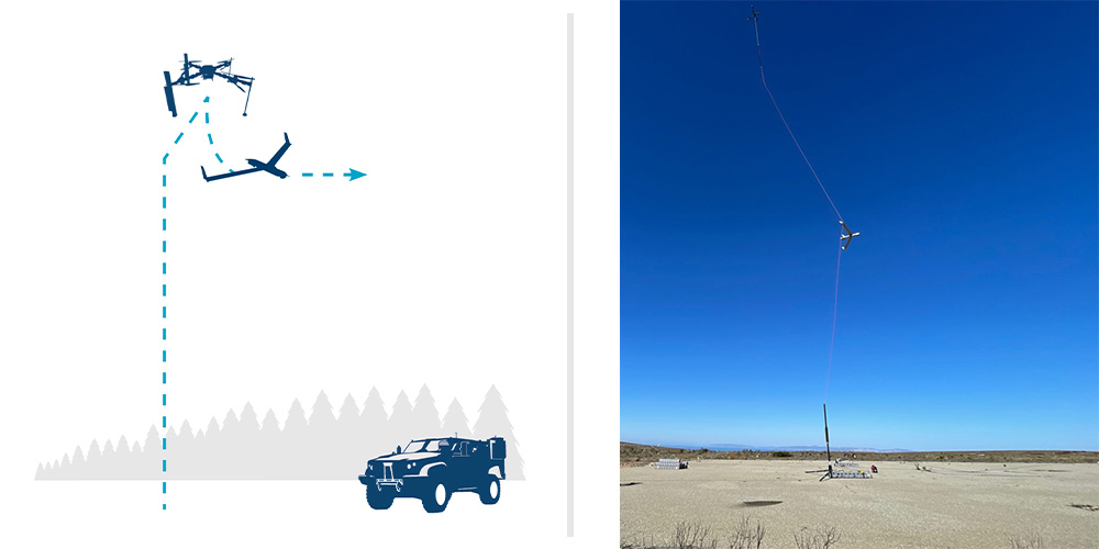
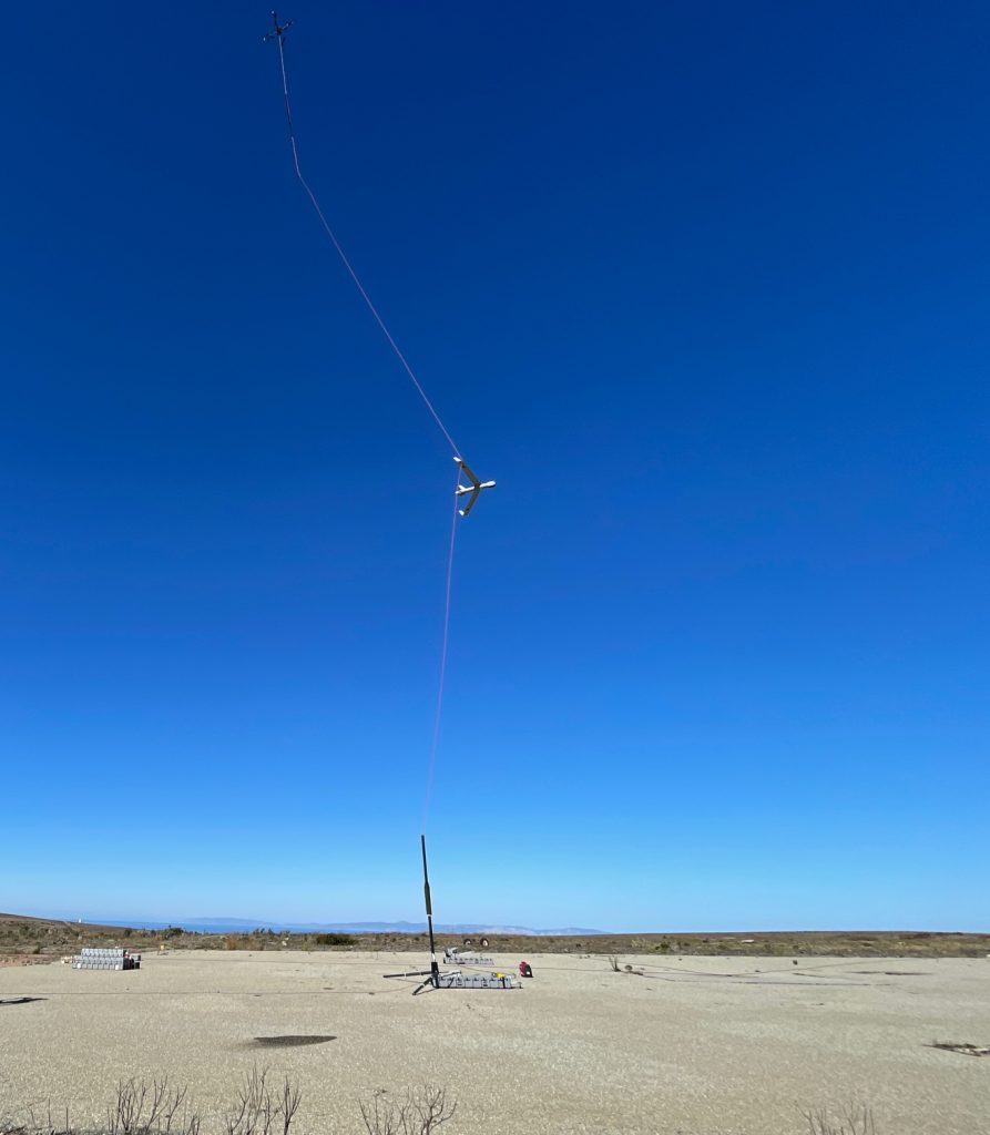
RECOVERY
FLARES takes off vertically tethered, hosting capture rope into the air (~300′). ScanEagle catches on vertical line via wing hook (<5 min)
FLARES descends as the capture rope is wheeled onto the winch in MARS (Mast Augmented Recovery System) and ScanEagle settles onto the top of the mast.
Unloaded FLARES lands.
Ready for Battle Management Systems
ScanEagle’s open architecture enables rapid integration with third‑party mission and battle‑management systems. Onboard autonomy includes automatic target recognition trained on decades of computer vision expertise, detect and advise, and other capabilities designed for one-to-many UAS operations.
Resilient in the Harshest Environments
ScanEagle delivers next-generation survivability for today’s and tomorrow’s contested, denied, and degraded airspace with autonomous and visual navigation, GPS-jam resilient guidance, adaptive RF switching, weather avoidance, and automated airspace safety (including DAA).
Game-Changing Range, Endurance, and Capacity
ScanEagle delivers 18+ hours of endurance, 17 lb payload capacity, and over-the-horizon SATCOM for persistent detection, classification, tracking, and targeting. Its VTOL kit enables expeditionary operations without sacrificing range, payload capacity, or power.
Flexible Operations From Front Lines or Rear Positions
ScanEagle’s endurance, range, and flexible launch/recovery enable operations from almost anywhere. The FLARES VTOL kit supports expeditionary ops with a small packout, set up and launched in 30 minutes by two operators. Rail launcher and Skyhook deliver runway‑independent ops from forward or established sites – no aircraft modifications required.
Ultimate VTOL Portability and Self-Sufficiency
FLARES VTOL kit enables rapid repositioning and tight‑space ops on land or at sea. Its small, transportable footprint supports island‑hopping, ship‑to‑shore, and other point‑to‑point missions, and it’s available to current ScanEagle users with no aircraft modifications.
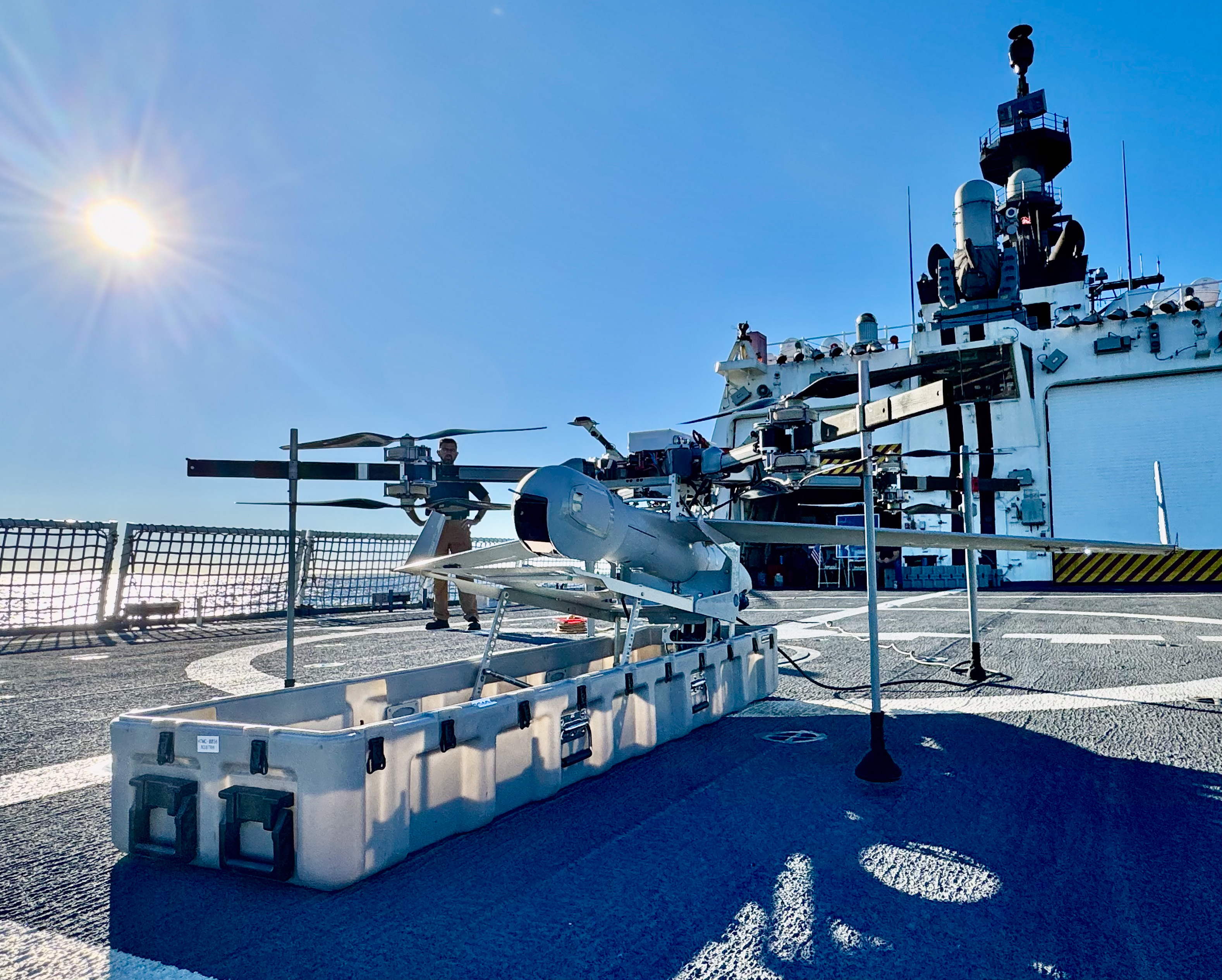
Optimized for Challenging Shipboard Operation
Born from decades of maritime ops, ScanEagle with the FLARES VTOL kit is hardened for heavy seas, high winds, and tight shipboard spaces, launching from small‑vessel helicopter decks even in high pitch and roll.
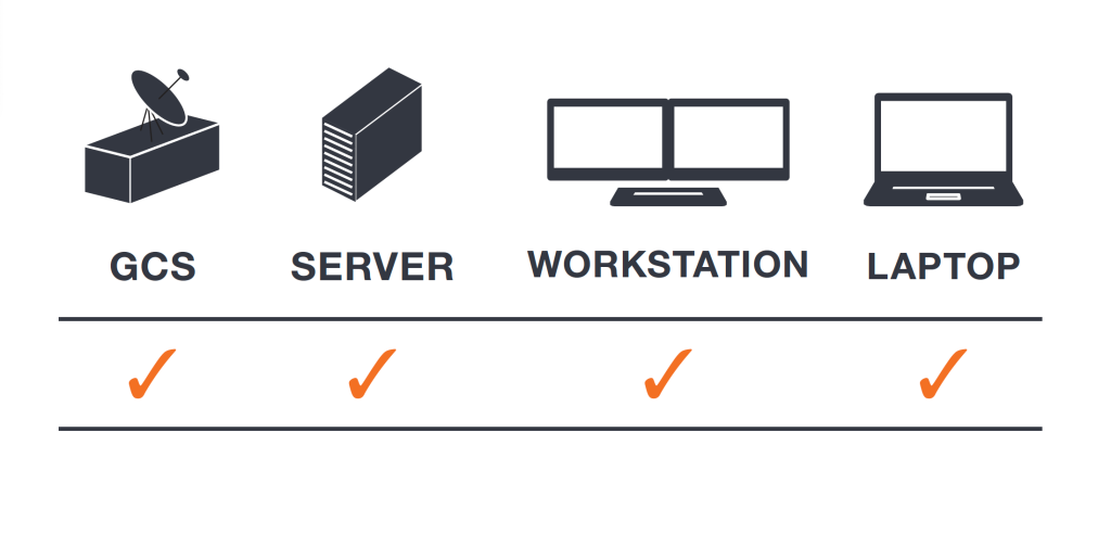
Truly Interoperable with Common Ground Control Station
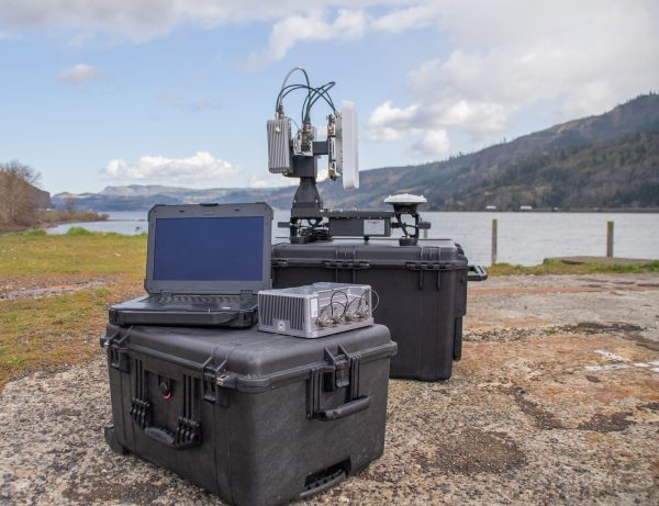
Insitu’s compact, modular cGCS minimizes footprint and maximizes interoperability. Configurable for vehicle, land, or shipboard use, it supports SATCOM, LOS control, and non‑Insitu UxVs.
Trusted Performance
With 1.5M+ combat operational hours and continuous land and maritime deployments since 2004, ScanEagle is battle‑proven with U.S. and international forces in harsh, contested environments.
Ready for Joint Operations
Compliant with relevant NATO and industry standards to allow interoperability across joint, coalition, and allied forces.
Payload Flexibility
Field-swappable payloads can be rapidly reconfigured to support a wide range of missions—electronic warfare, ISR, comms relay, overwatch and targeting.
These enhancements position ScanEagle as the premier choice for reliable over-the-horizon Beyond Line of Sight (BLOS) Intelligence, Surveillance, Reconnaissance and Targeting (ISR-T) missions
Insitu Launches Autonomy Centre of Excellence in Oxford, UK
Insitu announced the establishment of its new Autonomy Centre of Excellence in Oxford, UK, solidifying the company’s long-standing commitment to advancing practical autonomy and artificial intelligence (AI) solutions critical to the future of global defence.
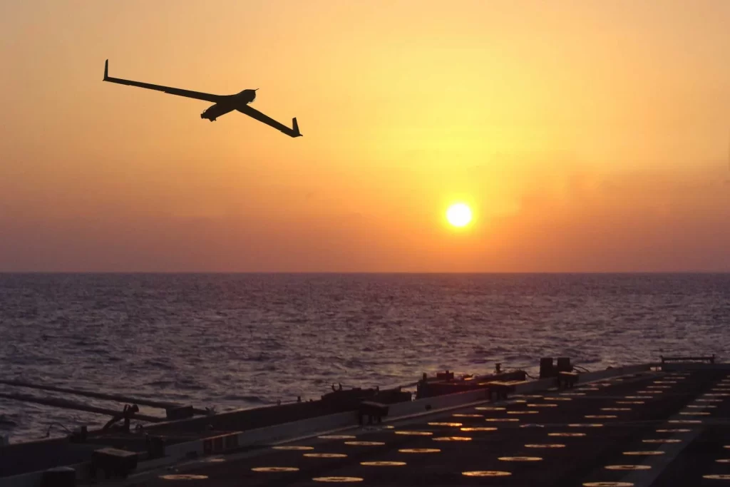
Brazilian Navy deploys ‘ScanEagle’ and NPA ‘Babitonga’ in exercise
The training included the participation of the Patrol Vessel “Babitonga” and the remotely piloted aircraft RQ-1 “ScanEagle” , integrating monitoring, patrolling and support actions for joint operations with the Army and Air Force .
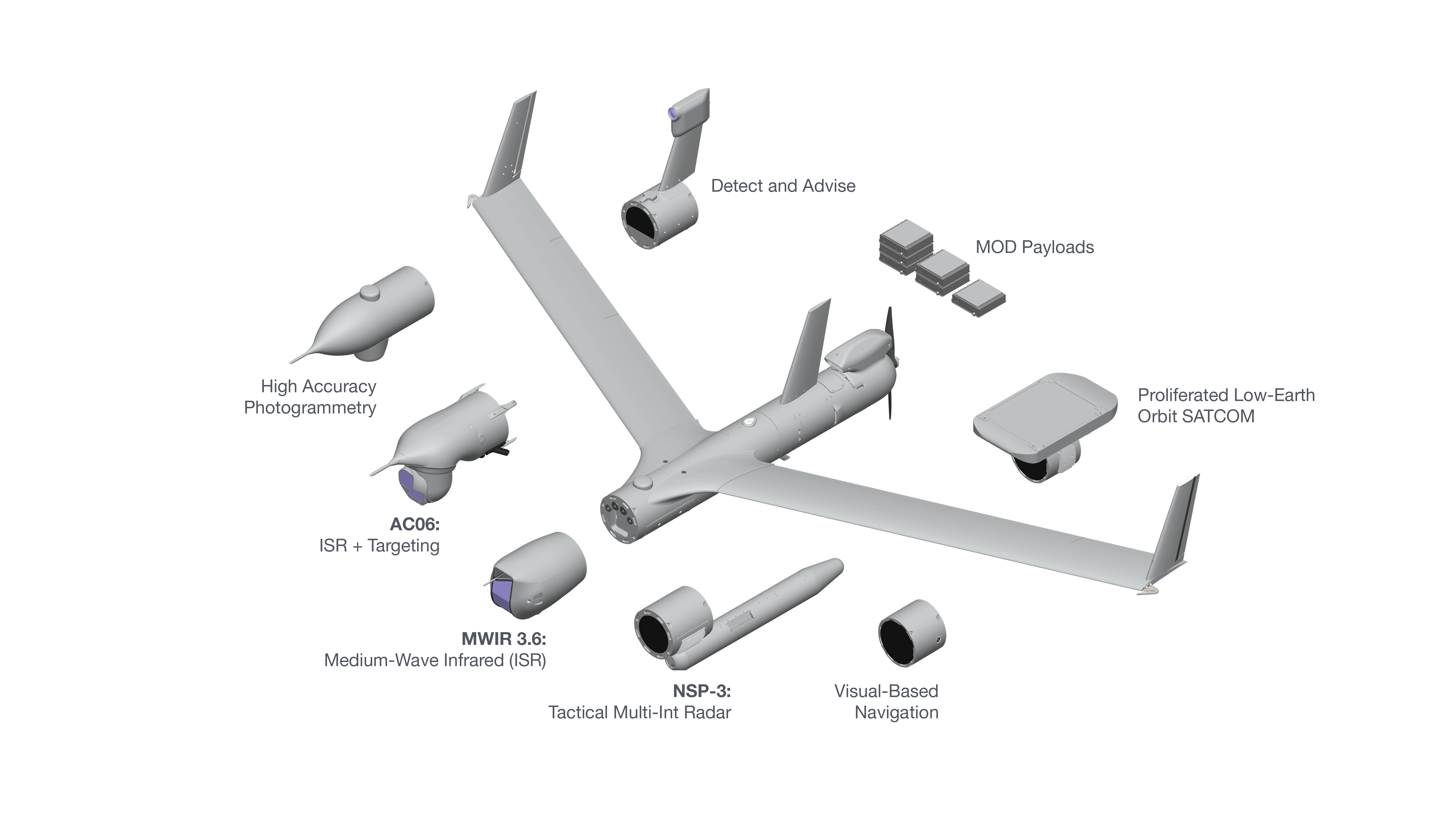
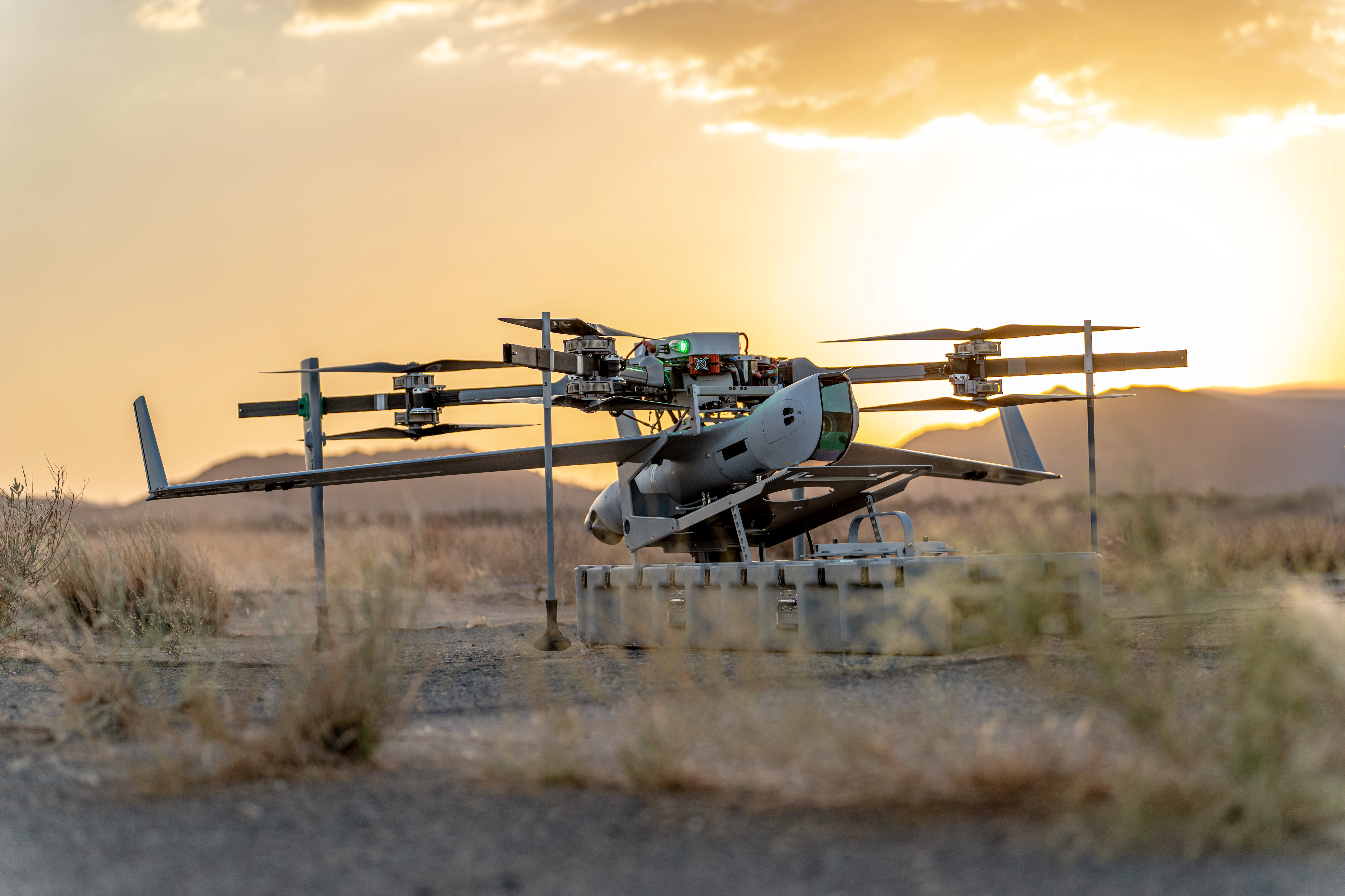
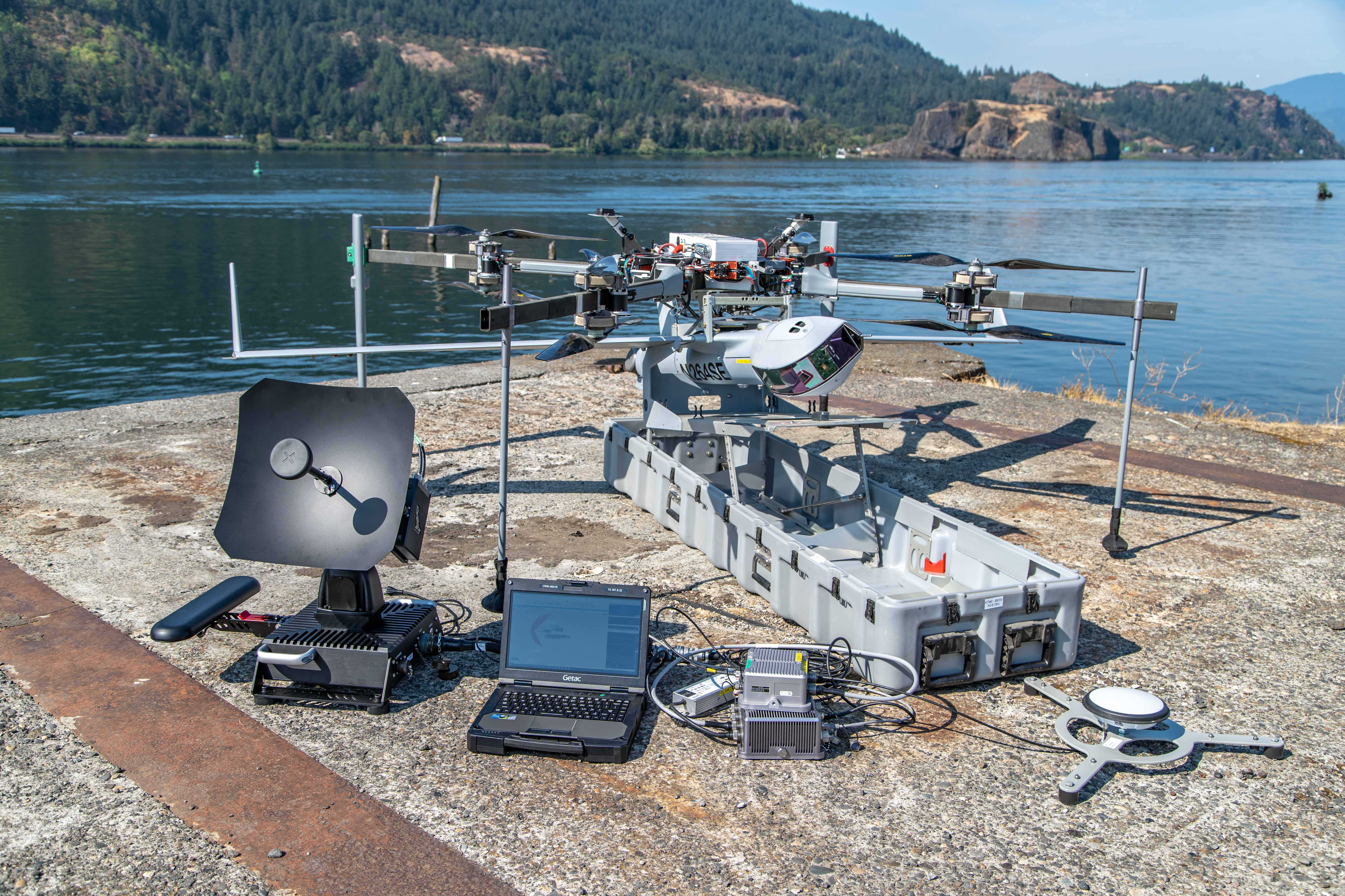
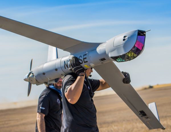
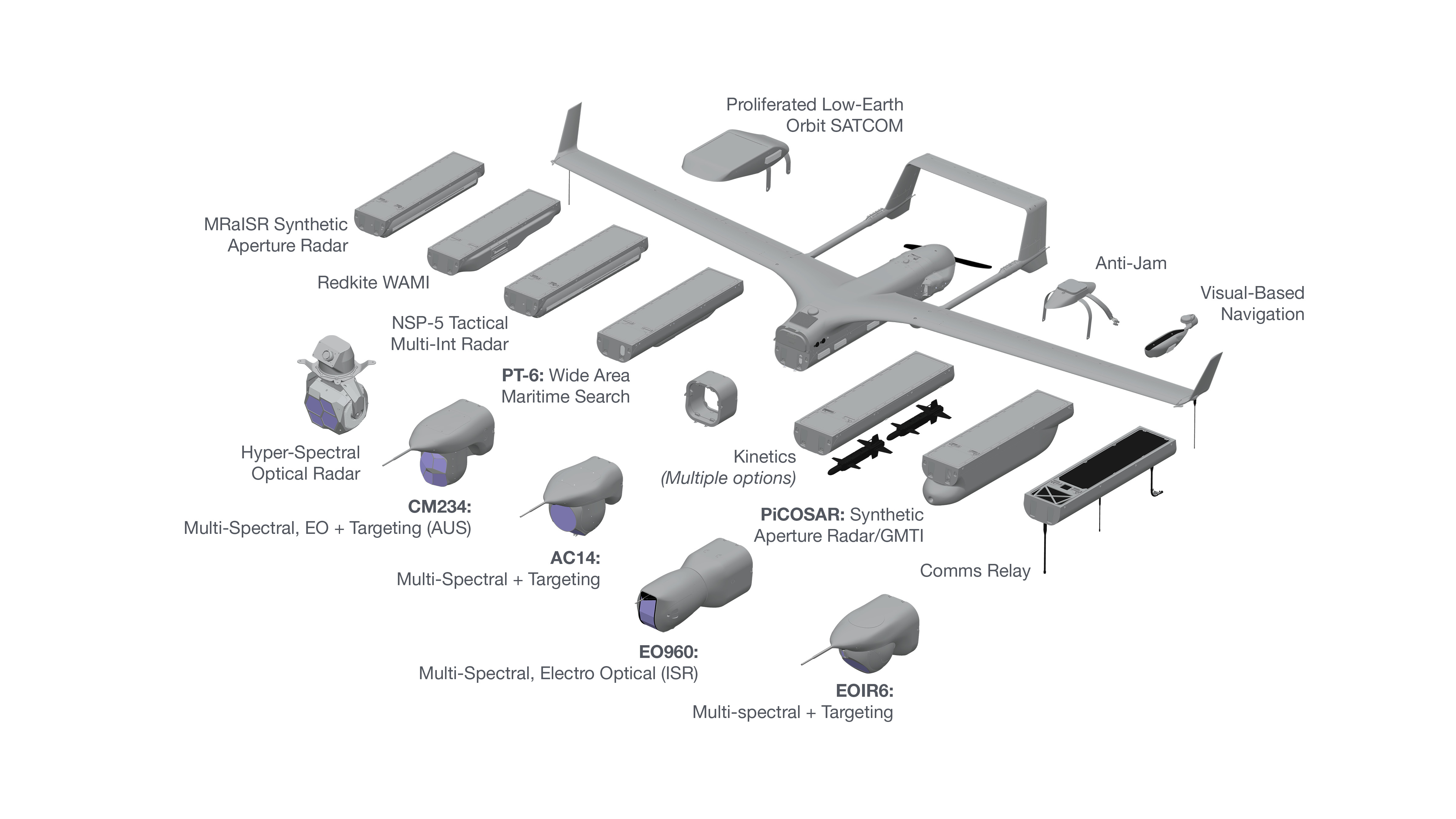
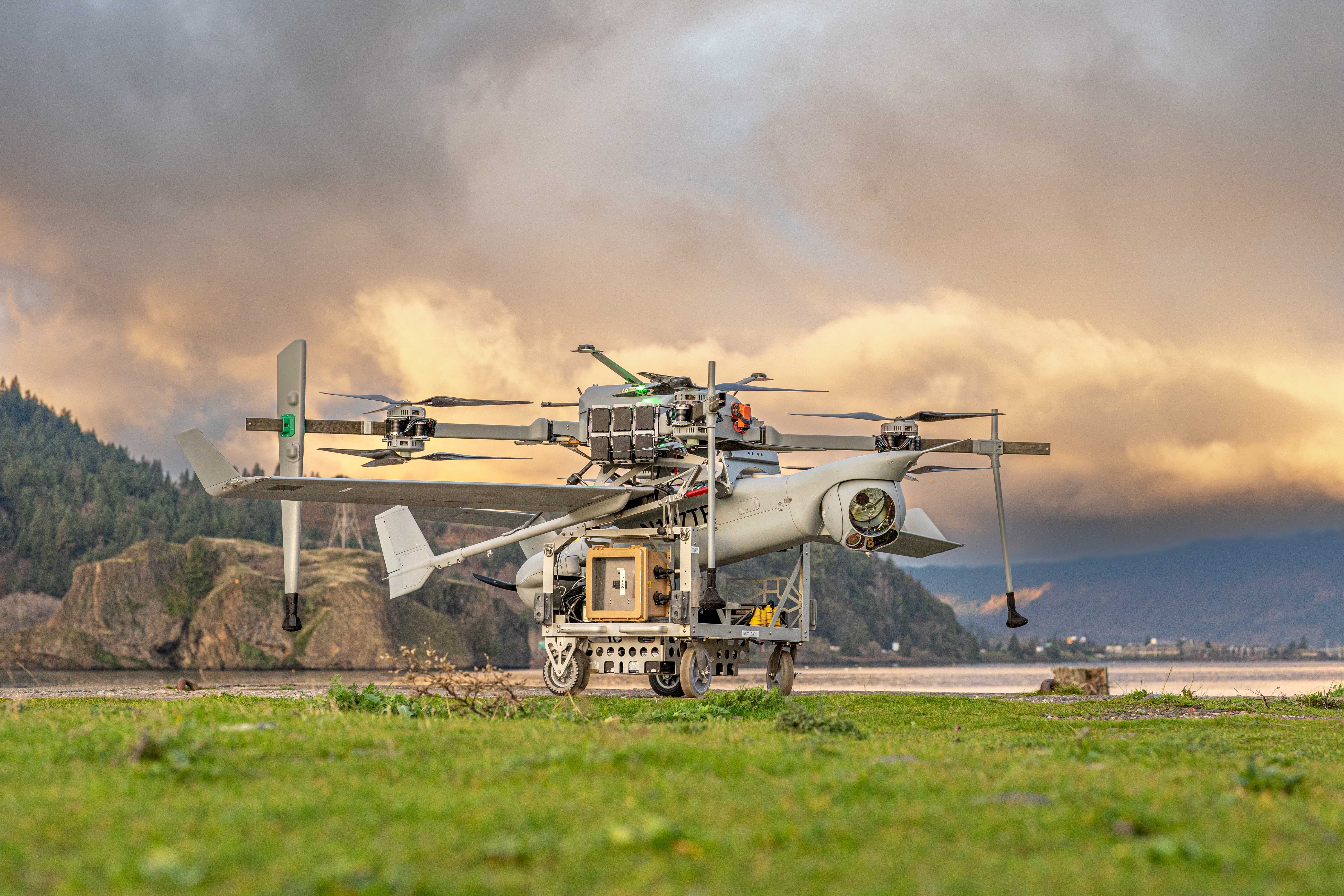
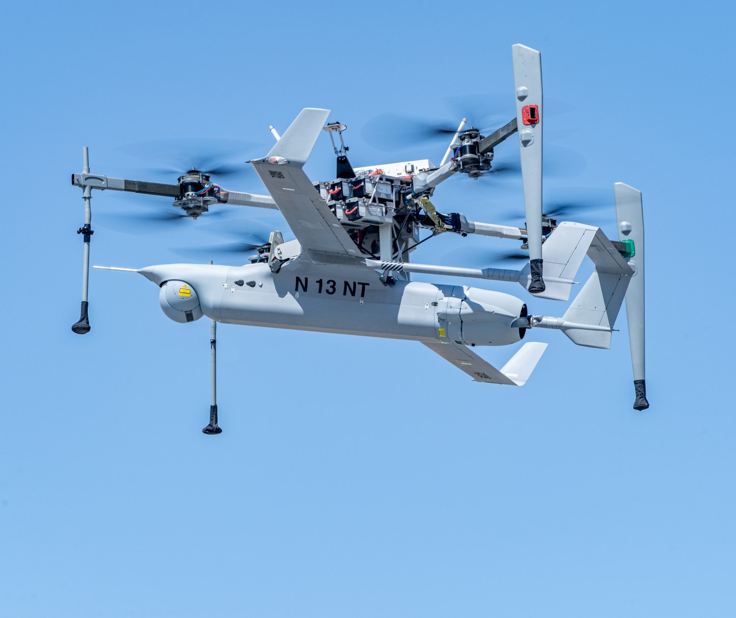
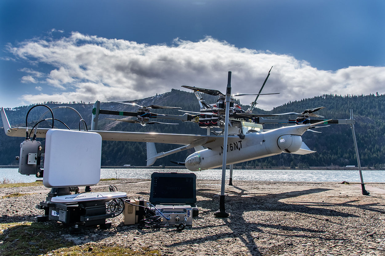
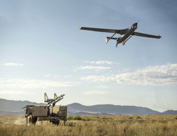
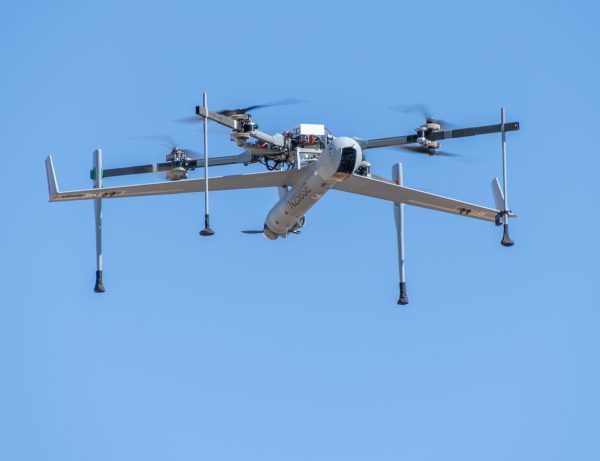
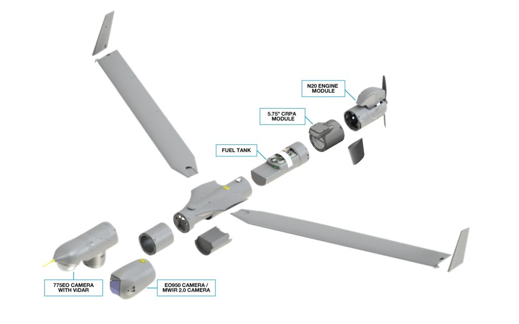
The Integrator is the most versatile UAS in its class, with a modular design to fit every mission. Endless configuration options include no-sacrifice VTOL and extended-range SATCOM capabilities.
Group 4/5 Capability
Fly multi-int, multi-domain missions that challenge Group 4/5 asset capabilities at a fraction of the acquisition and operation costs with up to 27.5-hour endurance, up to 2000 nmi range, and up to 50lb of payloads across 10 bays.
Small Footprint
Available with traditional rail launcher/Skyhook LRE and FLARES Vertical Take-off and Landing kit, which requires minimal deck space, can launch in high seas and gusty winds, and requires zero aircraft modifications.
Resilient Autonomy
Next-gen resilience features include visual-based navigation, autonomous RF switching, weatherization and more, ensuring mission success even in contested, denied, or degraded environments.
Alternative Navigation (Alt-Nav) including Visual-Based Navigation (VBN)
Kinetics
SIGINT, EW, comms relay, and more
FLARES VTOL Kit Specifications
Weight
Max Integrator weight 175 lb (79kg)
Temperature Range
-20º to +45º C
Wind Range
0-30 knots
10 knot gusts
Deck Motion
+/- 10 degrees roll
+/- 5 degrees pitch
Resilience Features
Encrypted GPS
Jam-resistant datalinks
Navigation solutions for GNSS-contested environments
Weatherization for extreme conditions
Full Mission Set Packout
463L pallet: 108 x 88 x 62 in (2.74 x 2.24 x 1.57 m)
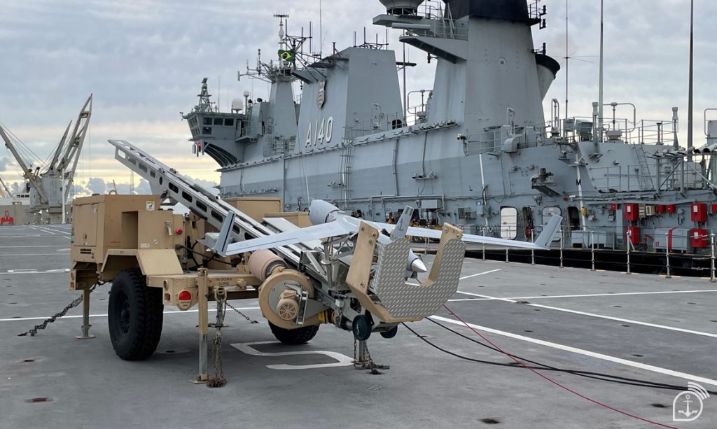
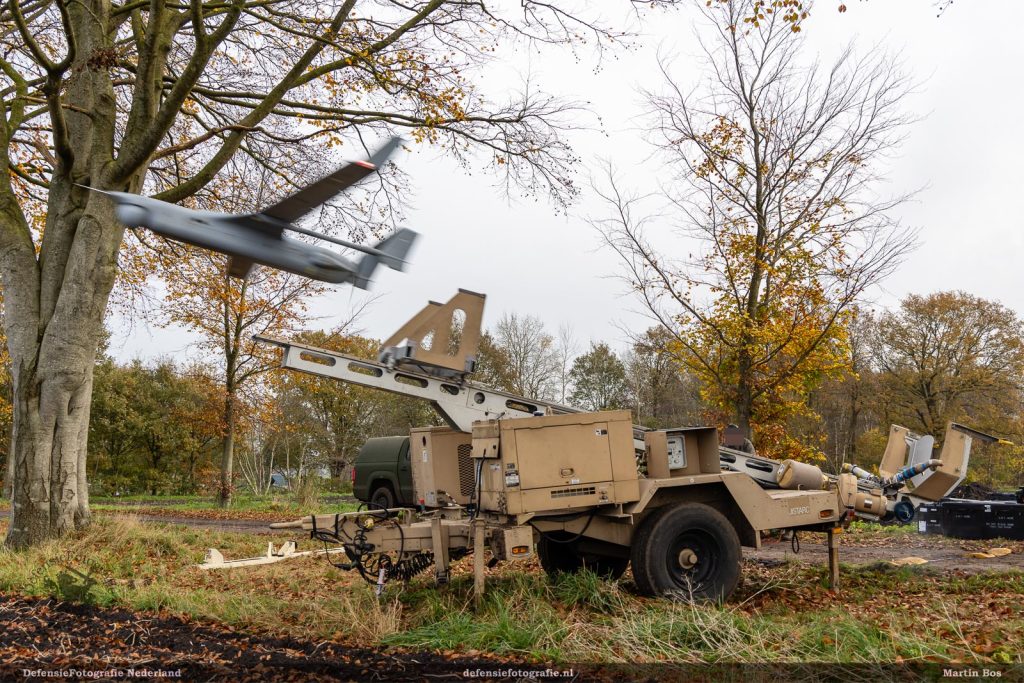
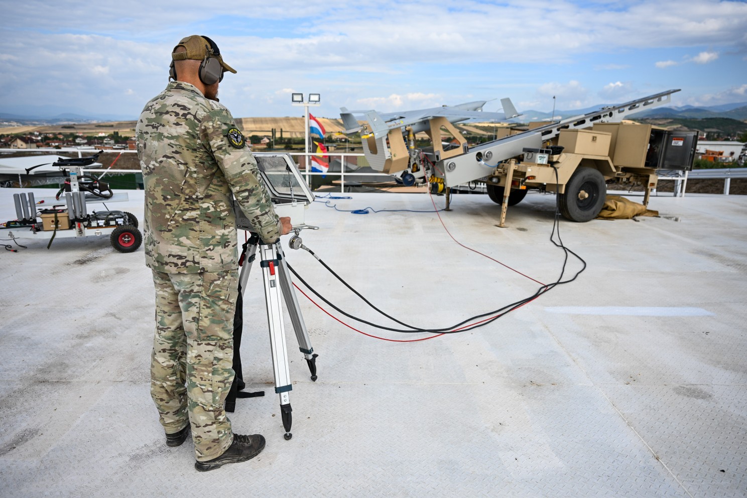
How does Integrator with VTOL work?
LAUNCH
FLARES, mated with Integrator, climbs vertically to altitude (500′ AGL), dashes into the wind, and releases Integrator into fixed-wing flight.
FLARES returns to land/ship via GPS
In case of an aborted launch, FLARES returns and lands vertically with Integrator still attached.
RECOVERY
FLARES takes off vertically tethered, hosting capture rope into the air (~300′). Integrator catches on vertical line via wing hook (<5 min)
FLARES descends as the capture rope is wheeled onto the winch in MARS (Mast Augmented Recovery System) and Integrator settles onto the top of the mast.
Unloaded FLARES lands on deck.
Resilient in the Harshest Environments
Integrator UAS offers next-gen survivability that’s critical to today’s (and tomorrow’s) battlespace. This includes autonomous navigation, GNSS/GPS jamming resilience, visual-based navigation, autonomous RF-switching, weather avoidance, and automated airspace safety features (including DAA) to ensure mission success even in contested, denied, or degraded environments.
Game-Changing Range, Endurance, and Capacity
Integrator offers up to 27.5 hours of endurance and 2,000 nmi range. Range and endurance enable persistent detection, classification, tracking, and targeting. This range/endurance paired with Integrator’s large payload capacity enables long-transit, long-dwell ISR+T and multi-intelligence missions normally reserved for larger, more expensive assets.
Flexible Operations From Front Lines or Rear Positions
With Integrator’s endurance, range, and flexible launch/recovery options, you can operate from just about anywhere. FLARES VTOL launch kit enables truly expeditionary ops, with a small packout that can be set up and launched in 30 mins with 3 operators. Traditional LRE (rail launcher and Skyhook) offer runway-independent operations from forward operating bases or other more established positions. The choice is yours – with no aircraft modifications required for either option.
Ultimate VTOL Portability and Self-Sufficiency
FLARES VTOL Kit enables rapid repositioning and operation in tight spaces on land or ship. It is easily transportable downrange for island-hopping, ship-to-shore, and other point-to-point operations.
Optimized for Challenging Shipboard Operation
Integrator is proven in challenging maritime environments around the globe. FLARES VTOL Kit is environmentally hardened and built to operate in heavy seas and high winds, with limited launch and stowage spaces in mind. Launches from small vessel helicopter decks in high pitch and roll environments.
Truly Interoperable with Common Ground Control Station
Insitu’s small, modular, and expandable cGCS with multiple configurations minimizes footprint and maximizes compatibility. Ideal for vehicle-mounted, land-based, or shipboard operations, cGCS works with SATCOM and line-of-sight control and also controls non-Insitu UxV.
Trusted Performance
Integrator has been truly battle-tested and deployed around the globe, flying in the harshest environments for a variety of US and international partners.
Interoperability
Compliant with relevant NATO and industry standards to allow interoperability across joint, coalition, and allied forces.
Search, interrogate, and prosecute from one long endurance platform via state-of-the-art, automated wide-area search with high-powered zoom optics, across multiple spectral bands.
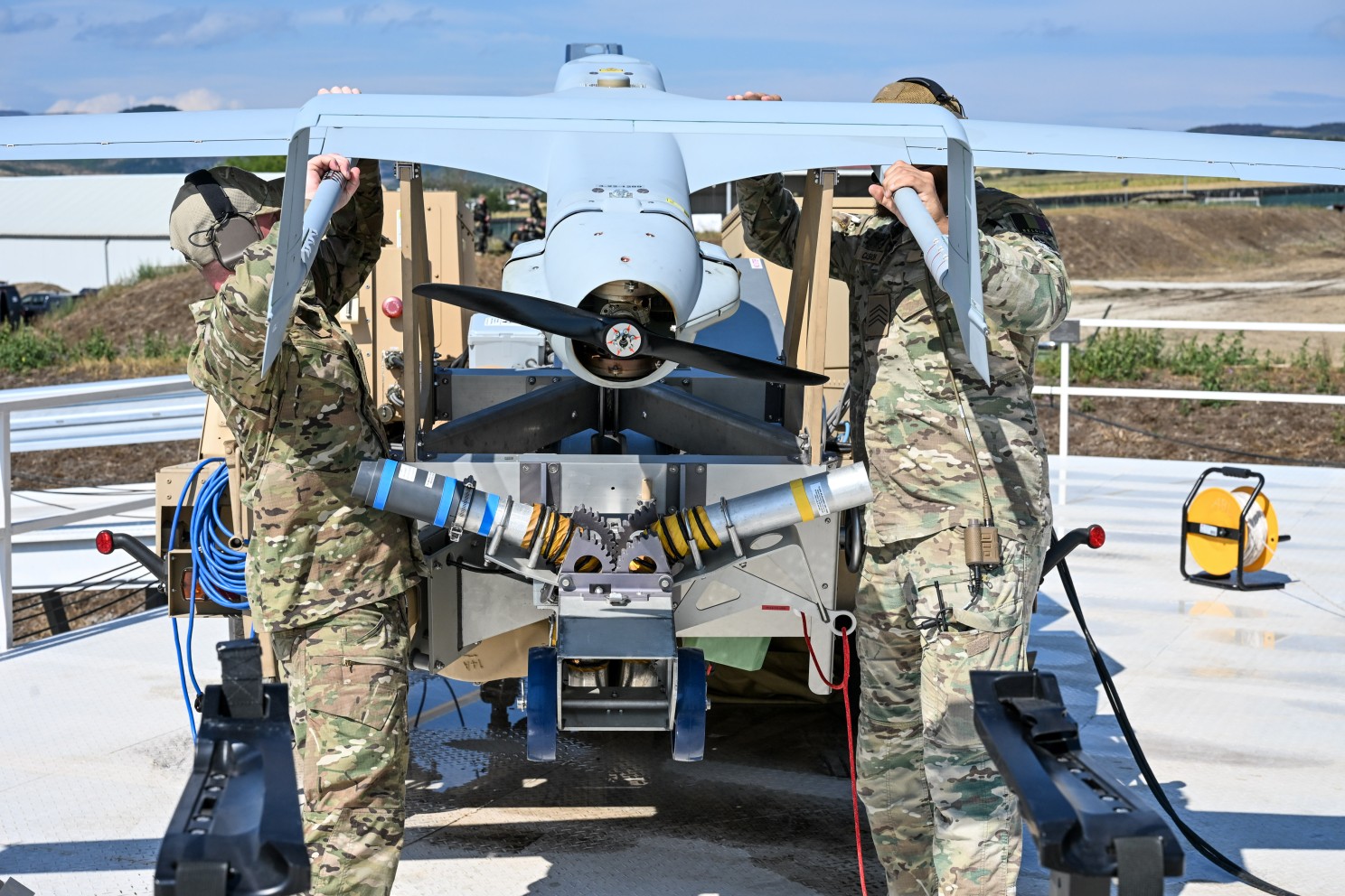
Insitu Announces Kinetic Capability for the Integrator Uncrewed Aircraft System (UAS)
Insitu, A Boeing Company, announced a munitions program for its Integrator UAS, which adds a highly sought-after strike capability to the platform’s unmatched payload portfolio and class-leading 24-hour flight endurance.
Insitu Incorporated, a Boeing company, reached a milestone this year: 30 years of unmanned aircraft innovation excellence – and nearly 20 years of supporting NATO, helping it to project NATO power on land and at sea from the air. ESD’s Curtis Hand spoke with Insitu CEO Diane Rose about what is next for the company in terms of current and future operational theatres, warfare’s evolution, and new industrial partnerships and strategic alliances – all to strengthen NATO and its affiliates.
Belgian Defence: The Integrator: Sustained Aerial Reconnaissance as Operational Added Value
The strength of the Integrator lies not only in the platform itself, but in the way it generates, processes, and disseminates information within an operational context.
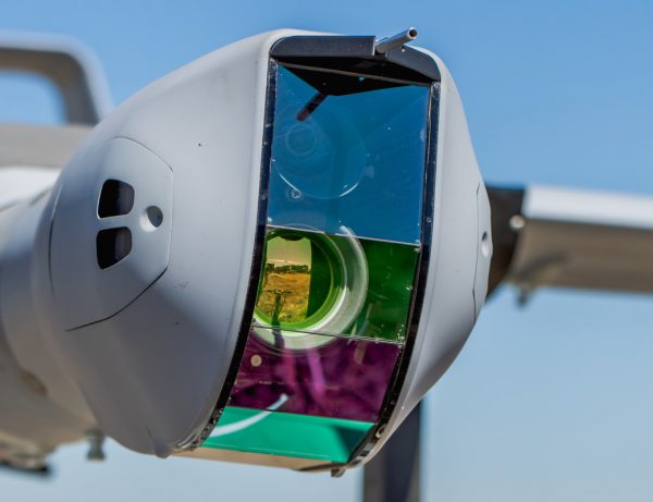
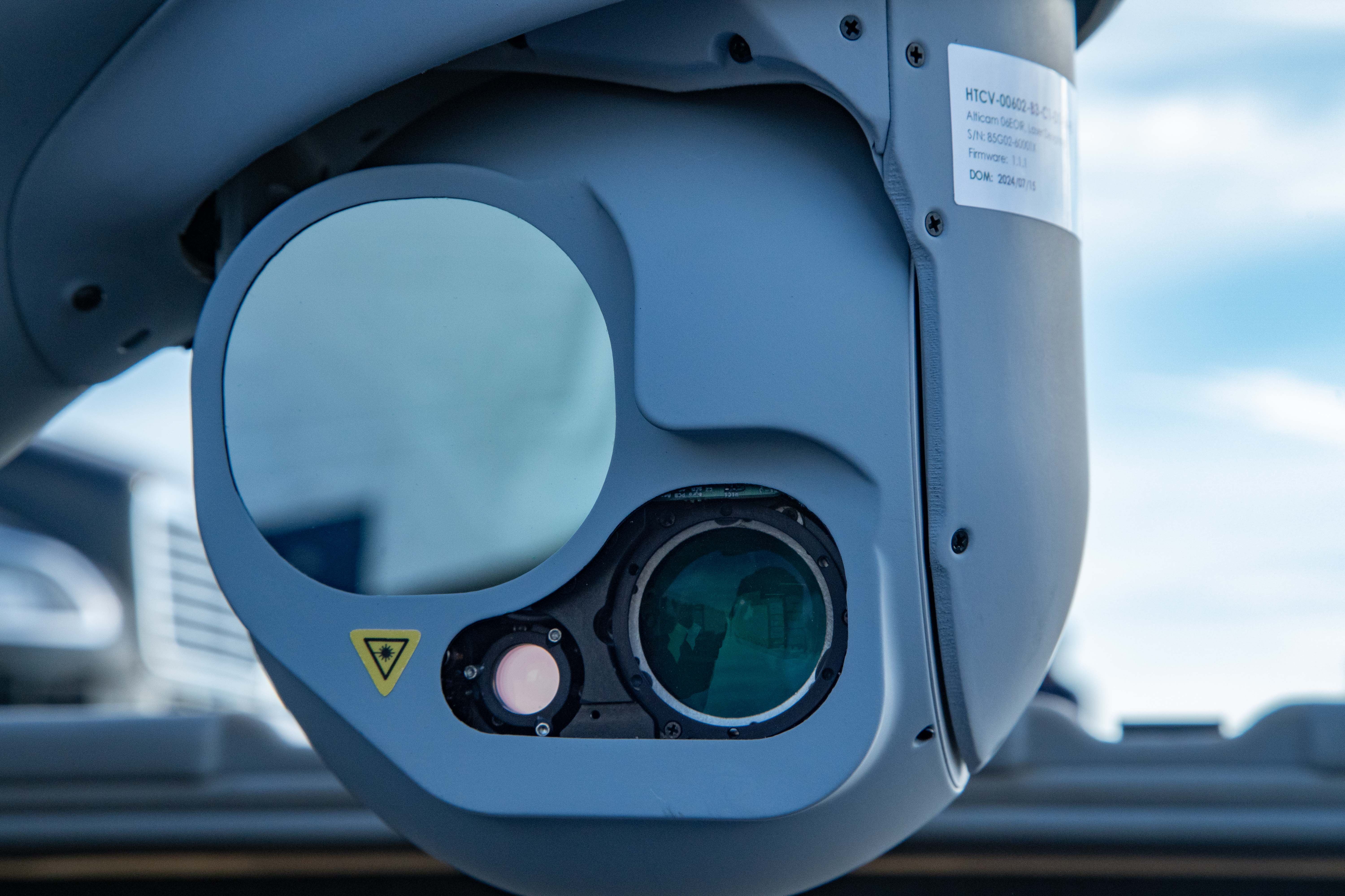
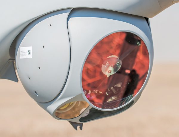
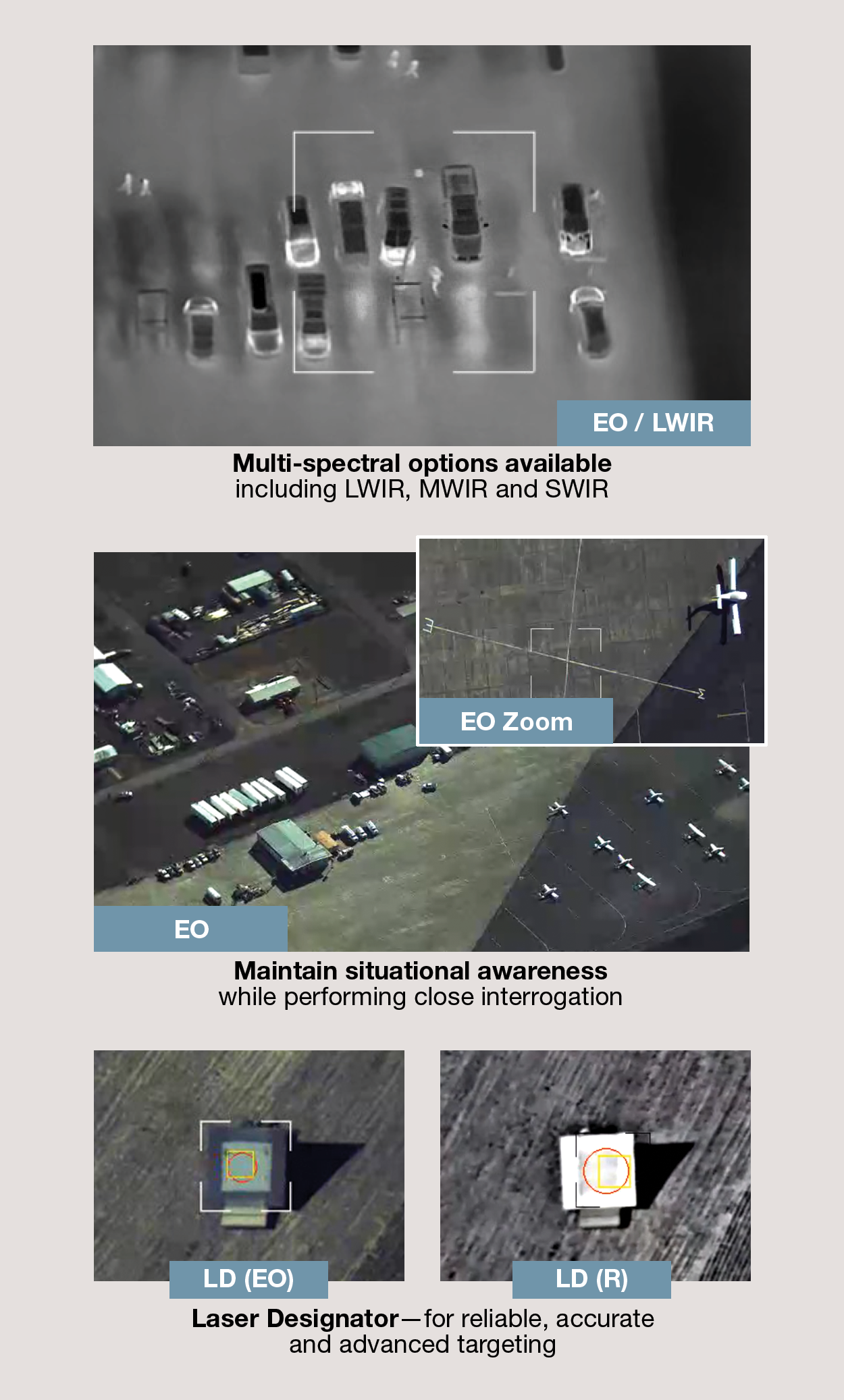
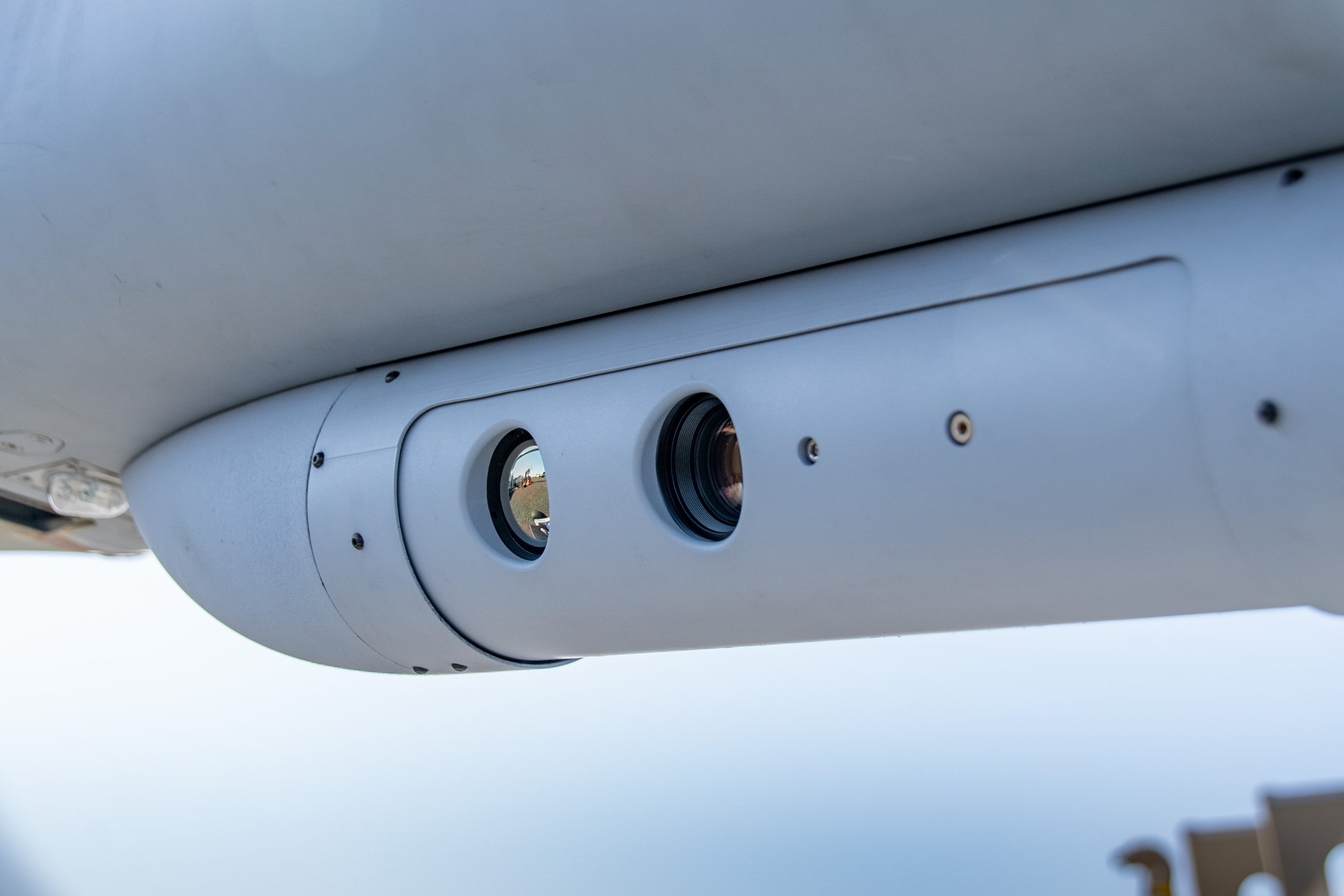
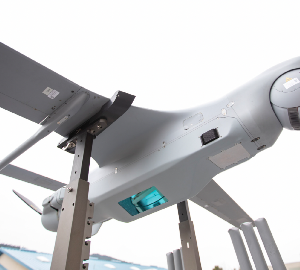
Electro-optical and multi-spectral ISR turret and superior laser designation targeting capabilities now available for battle-tested and maritime-proven ScanEagle UAS
Multi-Imager, Multi-Feed
Never lose sight of a target while simultaneously maintaining situational awareness.
Superior Targeting Support
Precise geo-spatial targeting via laser rangefinder, laser pointer, laser spot-tracker, and laser designator options.
Flexibility by Design
Multiple variants available, enabling customers to tailor capabilities to their specific needs.
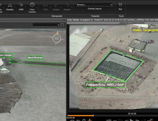
Decrease operator workload and increase success rates with automated features such as video motion target indicators (VMTI), embedded video processing, image stabilization, and target tracking .
ISR + Targeting
High-resolution optics and multi-image, multi-feed video signals allows for advanced intelligence, surveillance, and reconnaissance with laser targeting support.
Multi-spectral
A variety of multi-spectral variants available. Short-wave infrared (SWIR) telescope option adds the ability to see through smoke, fog and haze at an extended range.
Laser designation
Adds STANAG-3733-compliant laser designator and pointer for advanced targeting support.
Multiple Variants Available
Designed for ultimate flexibility, customers can choose from a variety of multi-spectral and EO optics with desired laser targeting options.
Additional benefits
4-Axis image stabilization
Two simultaneous H.264 or H.265 compressed video streams
Insitu Launches Autonomy Centre of Excellence in Oxford, UK
Insitu announced the establishment of its new Autonomy Centre of Excellence in Oxford, UK, solidifying the company’s long-standing commitment to advancing practical autonomy and artificial intelligence (AI) solutions critical to the future of global defence.
Brazilian Navy deploys ‘ScanEagle’ and NPA ‘Babitonga’ in exercise
The training included the participation of the Patrol Vessel “Babitonga” and the remotely piloted aircraft RQ-1 “ScanEagle” , integrating monitoring, patrolling and support actions for joint operations with the Army and Air Force .
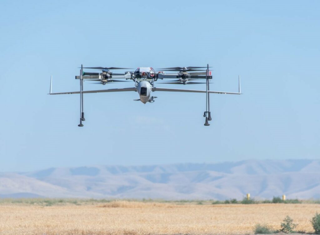
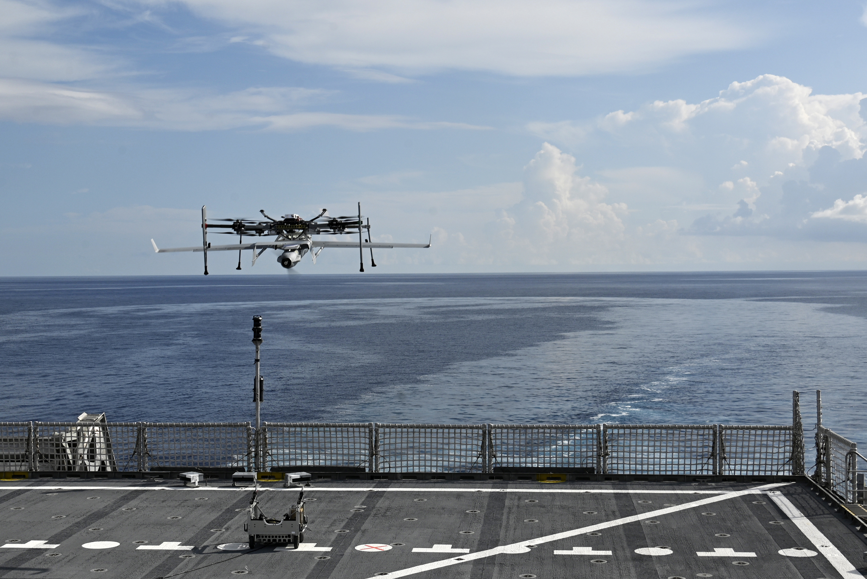
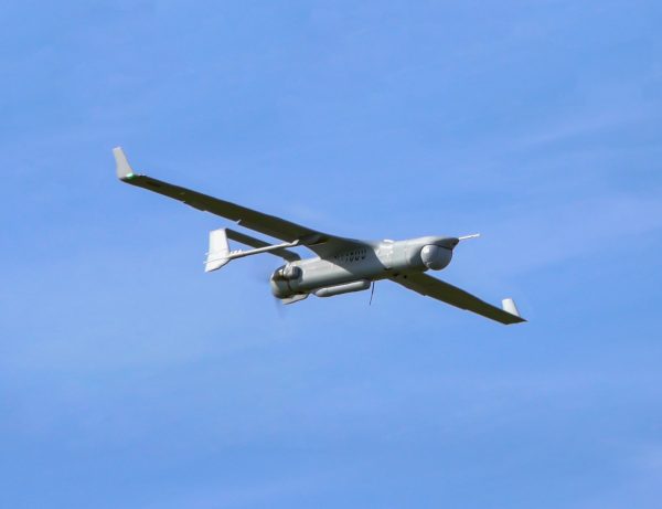
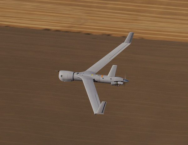
The UAS that invented the agile ISR category, Now with VTOL
ScanEagle paired with FLARES VTOL brings the smallest possible operational footprint while preserving maximum endurance and best-in-class, modular, payload capability.
Long-Endurance
ScanEagle’s 18+ hours of endurance carrying 17 lbs of Insitu best-in-class payloads means you’ll never lose sight of what’s most important.
Small Footprint
FLARES Vertical Take-off and Landing kit requires minimal deck or land space and requires zero aircraft modifications. Enables rapid repositioning and operation in tight spaces. Transportable via standard pickup truck or cargo van and ready to launch within 30 minutes.
Resilient
ScanEagle has been operating in GPS-contested and denied environments since 2018. Alt-nav and other solutions available.
463L pallet: 108 x 88 x 62 in (2.74 x 2.24 x 1.57 m)
ScanEagle Specifications
Size and Weight
Max takeoff weight: 62 lb / 28 kg
Max payload weight: 17 lb / 8 kg
Payload power: up to 150 W
Length: 5.6ft / 1.71m
Wingspan: 10.2 ft / 3.1 m
Sensor and Data Options
Electro-optical (EO) camera and telescope
Medium-wave infrared and EO for day-to-night operations
AI-assisted wide-area maritime search
Synthetic Aperture Radar (SAR): MMTI/GMTI, CCD
Laser range finder, laser pointer, and laser designator options
Electronic warfare / SIGINT / comms relay
AIS: Maritime vessel identification
Alternative Navigation (Alt-Nav)
Video Datalink: Analog, digital encrypted
C2 Datalink: Encrypted, unencrypted
Performance
Endurance: 18 hours
Ceiling: 19,500 ft / 5,950 m
Max horizontal speed: 80 knots / 41.2 m/s
Engine: Heavy fuel (JP-5 or JP 8) or C-10 gasoline engine
How does ScanEagle with VTOL work?
LAUNCH
FLARES mated with ScanEagle climbs vertically to altitude (500′ AGL), dashes into the wind, and releases ScanEagle into fixed-wing flight (<5 minutes).
FLARES returns to land/ship launch point
In case of an aborted launch, FLARES returns and lands vertically with ScanEagle still attached.
RECOVERY
FLARES takes off vertically tethered, hosting capture rope into the air (~300′). ScanEagle catches on vertical line via wing hook (<5 min)
FLARES descends as the capture rope is wheeled onto the winch in MARS (Mast Augmented Recovery System) and ScanEagle settles onto the top of the mast.
Unloaded FLARES lands.
Full Range, Endurance, and Capacity
ScanEagle with VTOL offers 18+ hours of endurance carrying 17 lb of Insitu’s best-in-class modular payloads. Range and endurance enable persistent detection, classification, and tracking.
Increased Portability and Self-Sufficiency
ScanEagle with VTOL enables rapid repositioning and operation in tight spaces on land or ship.
Available for Current ScanEagle Customers
FLARES VTOL kit works with existing ScanEagle UAS.
Common Ground Control Station
Small, modular, and expandable GCS with multiple configurations minimizes footprint and maximizes compatibility. Also controls non-Insitu UAV.
Trusted Performance
With over 1.3 million operational hours, ScanEagle has been continuously deployed on land since 2004 and at sea since 2005. ScanEagle is truly battle-tested – deployed around the globe, flying in the harshest environments for a variety of US and international partners.
Interoperability
Compliant with relevant NATO and industry standards to allow interoperability across joint, coalition, and allied forces.
Payload Flexibility
Field-swappable payloads can be rapidly reconfigured to support a wide range of missions—electronic warfare, ISR, comms relay, overwatch and targeting.
These enhancements position ScanEagle as the premier choice for reliable over-the-horizon Beyond Line of Sight (BLOS) Intelligence, Surveillance, Reconnaissance and Targeting (ISR-T) missions
Insitu Launches Autonomy Centre of Excellence in Oxford, UK
Insitu announced the establishment of its new Autonomy Centre of Excellence in Oxford, UK, solidifying the company’s long-standing commitment to advancing practical autonomy and artificial intelligence (AI) solutions critical to the future of global defence.
Brazilian Navy deploys ‘ScanEagle’ and NPA ‘Babitonga’ in exercise
The training included the participation of the Patrol Vessel “Babitonga” and the remotely piloted aircraft RQ-1 “ScanEagle” , integrating monitoring, patrolling and support actions for joint operations with the Army and Air Force .
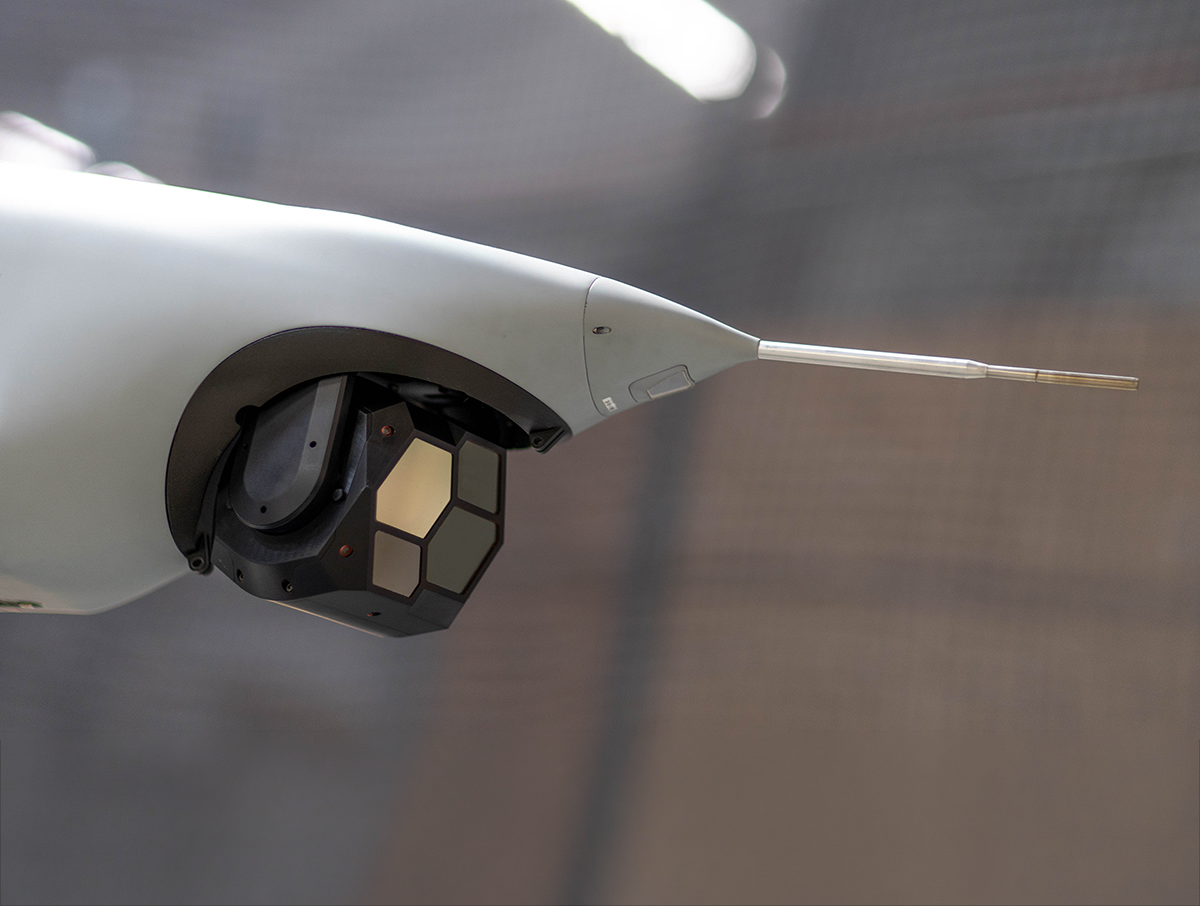
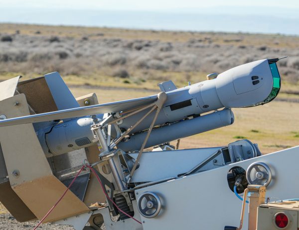
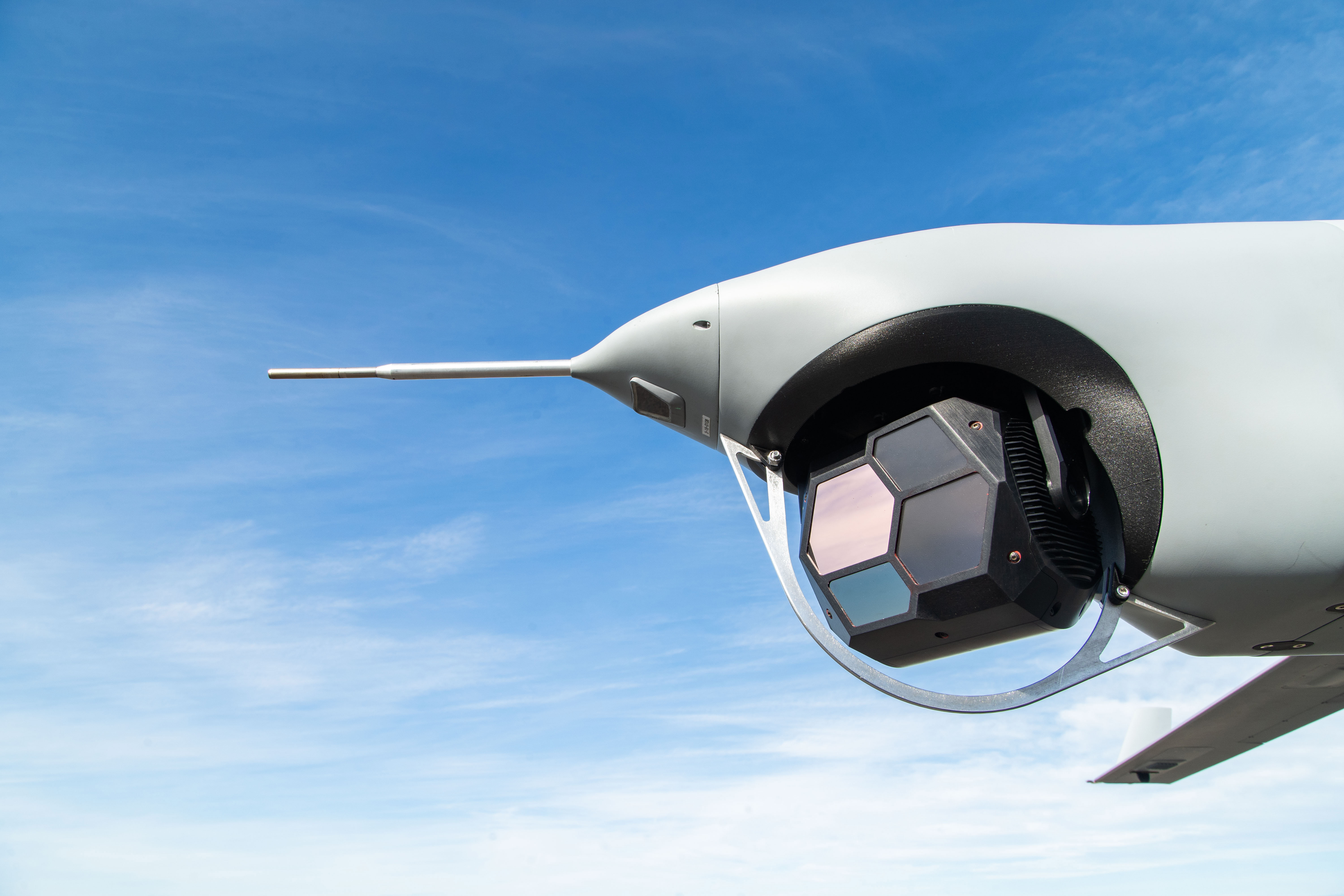
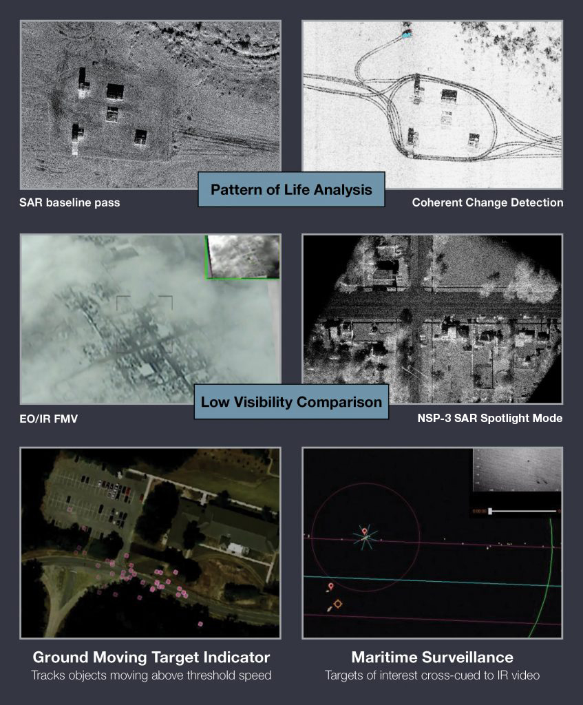
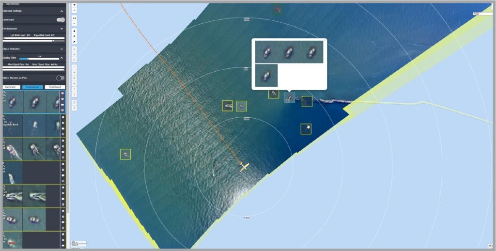
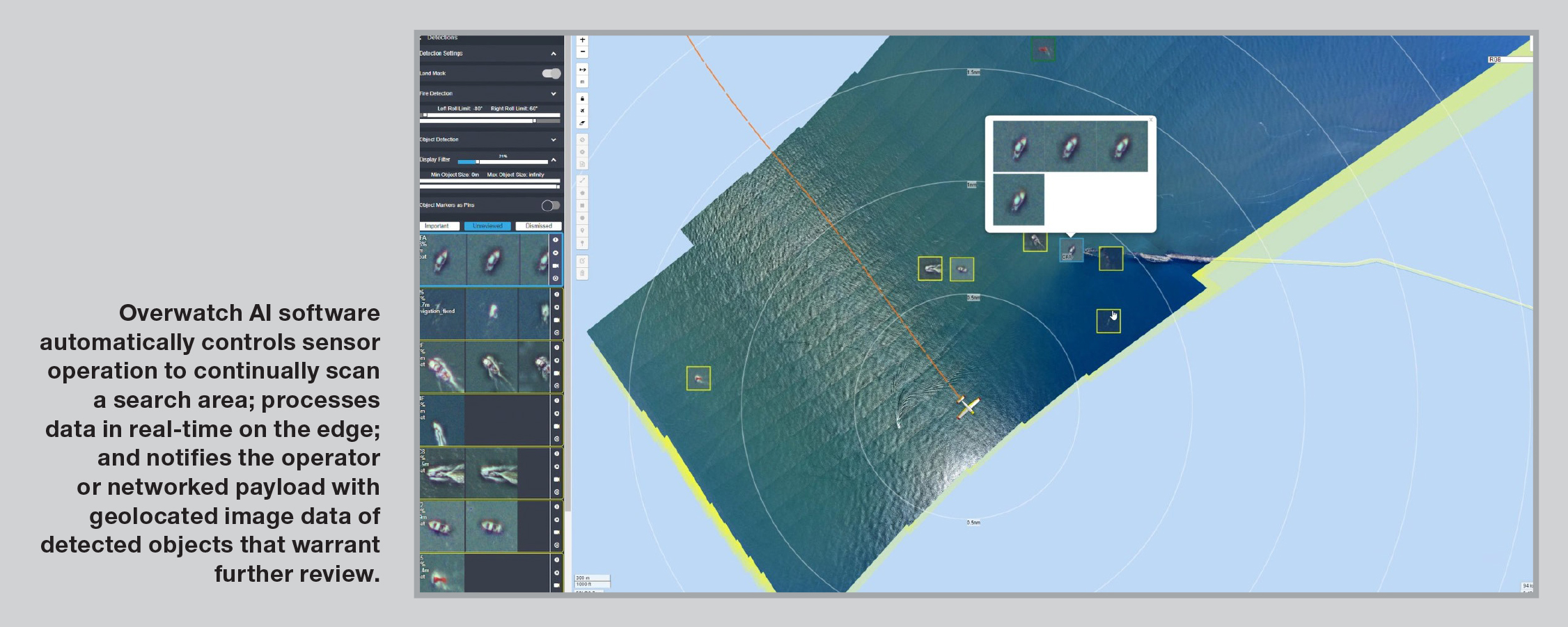
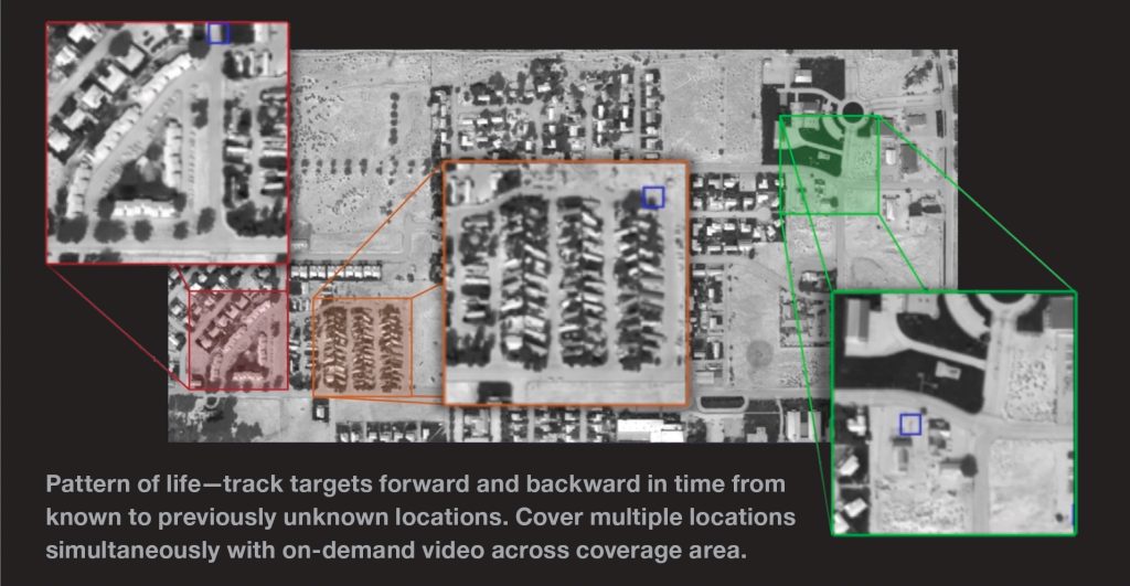
Automated Maritime Wide-Area Search for Integrator
AI-assisted wide-area search with high-powered zoom optics and multiple spectral bands. Search, interrogate, and prosecute from one long endurance platform.
Automate Your Search
Scans wide areas for objects of interest, processes imagery on the edge, and provides real-time information to operators, networked payloads, or mission management systems.
Program Your Missions
Designate automated search areas and detection thresholds based on mission parameters to optimize sensor and software operation.
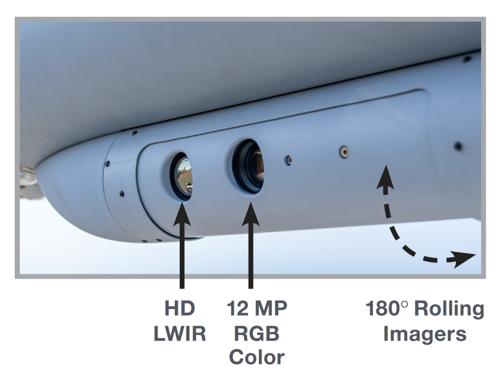
Search from Day to Night
Equipped with HD RGB and HD LWIR sensors. Nighttime heat/object detections, particularly in maritime environments, are aided by the contrast of thermal signatures against a uniform body of water.
PT-6 scans wide areas for objects of interest, processes imagery on the edge, and provides real-time information to operators, networked payloads, or mission management systems.
Detection Ranges and Coverage
Examples of targets and coverage based on size, altitude and speed (assumes 55 kts)
Target Size
Altitude (AGL)
Detection Range
Search Swath
Coverage Rate (per hour)
2 m life raft
1,000 ft (305m)
2 NM (3.7km)
4 NM (7km)
220 NM2 (755 km2)
19 m vessel
5,000 ft (1,500m)
10 NM (18.5km)
20 NM (37km)
1,100 NM2 (3,773 km2)
50+ m vessel
5,000 ft (1,500m)
17 NM (31.5km)
34 NM (63km)
1,870 NM2 (6,414 km2)
Let AI Do the Heavy Lifting
PT-6 automates the labor-intensive role of searching for small targets of interest in large areas, often in challenging conditions. Overwatch AI software automatically controls sensor operation to continually scan a search area; processes data in real-time on the edge; and notifies the operator or networked payload with geolocated image data of detected objects that warrant further review.
Expand Your Field of View
The sensor automatically scans in a step-stare pattern that sweeps across the flight track to provide a significantly increased search coverage area.
Go Day to Night with Multi-spectral Sensors
RGB and Long Wave Infrared (LWIR) allow you to search from day to night, and easily pick out warm heat signatures against a cool, uniform body of water.
Do it All with Multi-Mission Capabilities
PT-6 enables a wide variety of mission capabilities, from maritime search and ISR to land-based tactical intelligence, inspection and mapping, custom object detection, change detection, and more.
Stay On Target Longer with Unmatched Endurance
Integrator is designed for easy integration of multi-INT payloads, offers 24+ hours of endurance, and carries 40 pounds of Insitu best-in-class, modular, field-swappable payloads across six bays, with plenty of onboard power.
PT-6 is developed and produced by Overwatch Imaging and integrated and tested with Integrator in collaboration between Insitu and Overwatch Imaging
UBIQ Aerospace and Boeing Insitu Establish Visionary Partnership to Redefine Cold Climate Aircraft Technology
UBIQ Aerospace, a pioneering leader in cold weather and ice protection technologies, is excited to announce a groundbreaking collaboration with Boeing/Insitu, a renowned uncrewed aircraft systems (UAS) provider within The Boeing Company.
Insitu and Innovaero to develop unmanned aerial attack systems
Drone manufacturer Insitu Pacific (IPL) and aeronautical manufacturer Innovaero are to collaborate in the development of a long-range strike capability using uncrewed aircraft systems (UAS).
Insitu Announces Kinetic Capability for the Integrator Uncrewed Aircraft System (UAS)
Insitu, A Boeing Company, announced a munitions program for its Integrator UAS, which adds a highly sought-after strike capability to the platform’s unmatched payload portfolio and class-leading 24-hour flight endurance.
Building blocks for powerful still and motion imagery media applications
Designed for developers
Offers an extensive C++ API to operate on media from a range of sources including cameras, network streams, archives, and more.
Versatile architecture
Ideal for systems that require the capability to ingest, process, and deliver a large number of streams of video, audio, metadata, and annotation with minimal latency.
Adaptable, layered capabilities
Encoding and decoding, recording and playback, and advanced content-based retrieval and analysis via simultaneous media sources across many platforms.
Build client-side, metadata-rich media consumption and server software
Digitally encode motion imagery and metadata to MISB standards using encoding libraries and MainConcept codecs – no need for specialized video encoding software
Decode digital motion imagery and metadata for use directly in your software
Make your solution MISB and STANAG compliant with core components including MISB metadata set libraries, Cursor-on-Target encoders/decoders, NITF libraries, and video codecs (view the MISB standards here)
The de facto ISR industry standard for motion imagery interoperability
Ideal for companies and platforms that demand flexible, superior, real-time digital media solutions
Contains a comprehensive bundle of sample applications including a full-featured media client and server, remote server management application, and media streaming application
Currently used in numerous cross-domain solutions to meet NSA Raise The Bar requirements
Available with get-you-started technical support and support cases
Insitu Announces Kinetic Capability for the Integrator Uncrewed Aircraft System (UAS)
Insitu, A Boeing Company, announced a munitions program for its Integrator UAS, which adds a highly sought-after strike capability to the platform’s unmatched payload portfolio and class-leading 24-hour flight endurance.
On the Coast of Rio, Navy RQ-1 ScanEagle Aircraft Participated in Search and Rescue Operation
Its ability to remain for a long time in the search area, combined with the electro-optical sensor of great range and the geolocation capacity of the system, allow a more precise and effective location of the intended objective in the Search and Rescue (SAR – Search and Rescue) mission .
RedKite® Block II is a small electro-optical system capable of monitoring a city-sized area in real time. BlackKite® takes your city-wide search from day to night using Mid-Wave Infrared (MWIR).
Enables wide-area monitoring
Monitors 10 mi² (16 km²) area within line-of-sight range of the GCS
Onboard data storage
RedKite offers up to 8 hours of mission data (11 hours for BlackKite) onboard vehicle supporting real-time or historical data
Real-time alerts
User-defined “watchboxes” provide sensor operators with automated alerts when items of interest move in/out for real-time tracking
Compact embedded processing: North-up rendering, real-time and DVR streaming, and full-mission storage
Internal Data link: Fully integrated, single Line Replaceable Unit (LRU)
Cross cue
Support cross-cueing to Integrator’s primary FMV turret for higher resolution interrogation of subjects of interest.
Support multiple operators
Support multiple sensor operators with up to 10 video streams at once, each viewing independent streams. Geospatial and temporal bookmarking allows users to mark and share locations.
Automated detection alerts
User-defined “watchboxes” provide sensor operators with automated alerts when items of interest move in/out for real-time tracking.
Simultaneous target detection
Detect, track, and label geographically dispersed still or moving targets.
Forensic Analysis
Operators can rewind imagery in forensic mode to trace targets to their points of origin and review events.
RedKite and BlackKite are integrated and tested in collaboration between Insitu and Logos Technologies.
Insitu Pacific’s Uncrewed Next-gen Sensors Demonstrated at U.S. Army Exercise
Insitu Pacific demonstrated next generation sensor capabilities and autonomous technologies in California as part of the U.S. Army’s Project Convergence 2022 late last year.
Insitu Sets Company Record for Longest Flight at 25.5 hours with its Integrator Uncrewed Aircraft System
Insitu, A Boeing Company, recently set a company record for the longest duration flight with a 25.5-hour sortie with its Integrator Uncrewed Aircraft System (UAS) on an operational mission.