The UAS that invented the agile ISR category
Offering VTOL, SATCOM, and advancing resilience capabilities
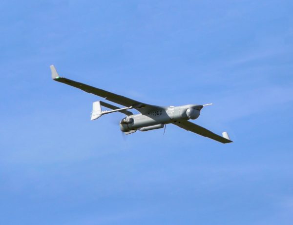
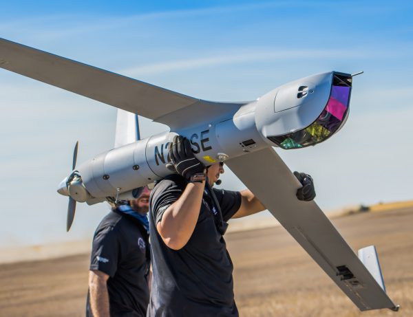
With over 1.6 million combat flight hours, ScanEagle is the industry’s most trusted long-endurance UAS. Electronic resilience features, SATCOM, VTOL, AI-enabled payloads, and the same best-in class endurance make today’s updated ScanEagle ready for the battlespace of tomorrow.
Long-Endurance
ScanEagle’s 18+ hours of endurance carrying 17 lbs of Insitu best-in-class payloads means you’ll never lose sight of what’s most important. PLEO SATCOM enables enhanced over-the-horizon ops.
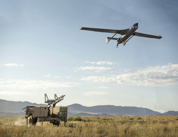
Launch Anywhere
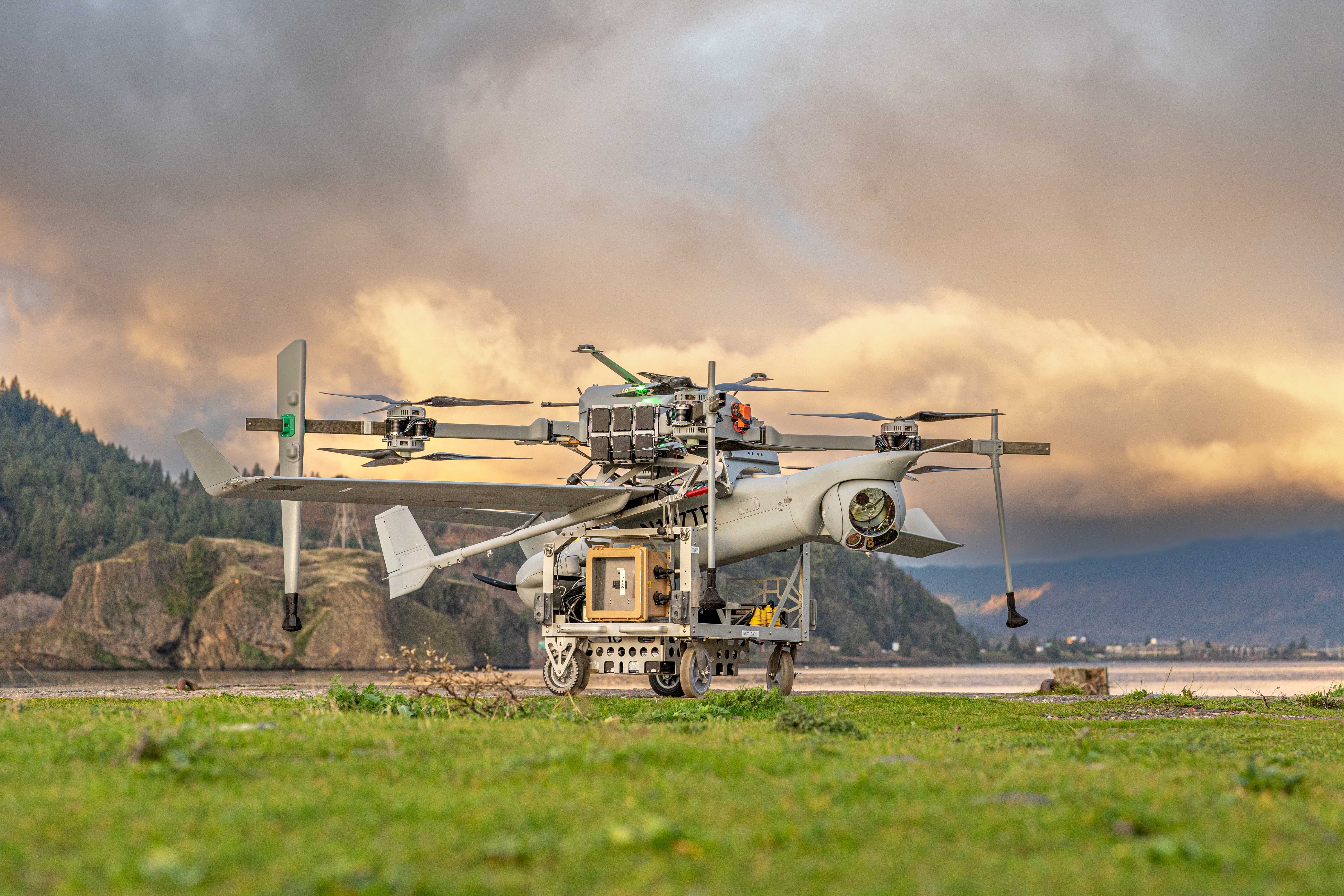
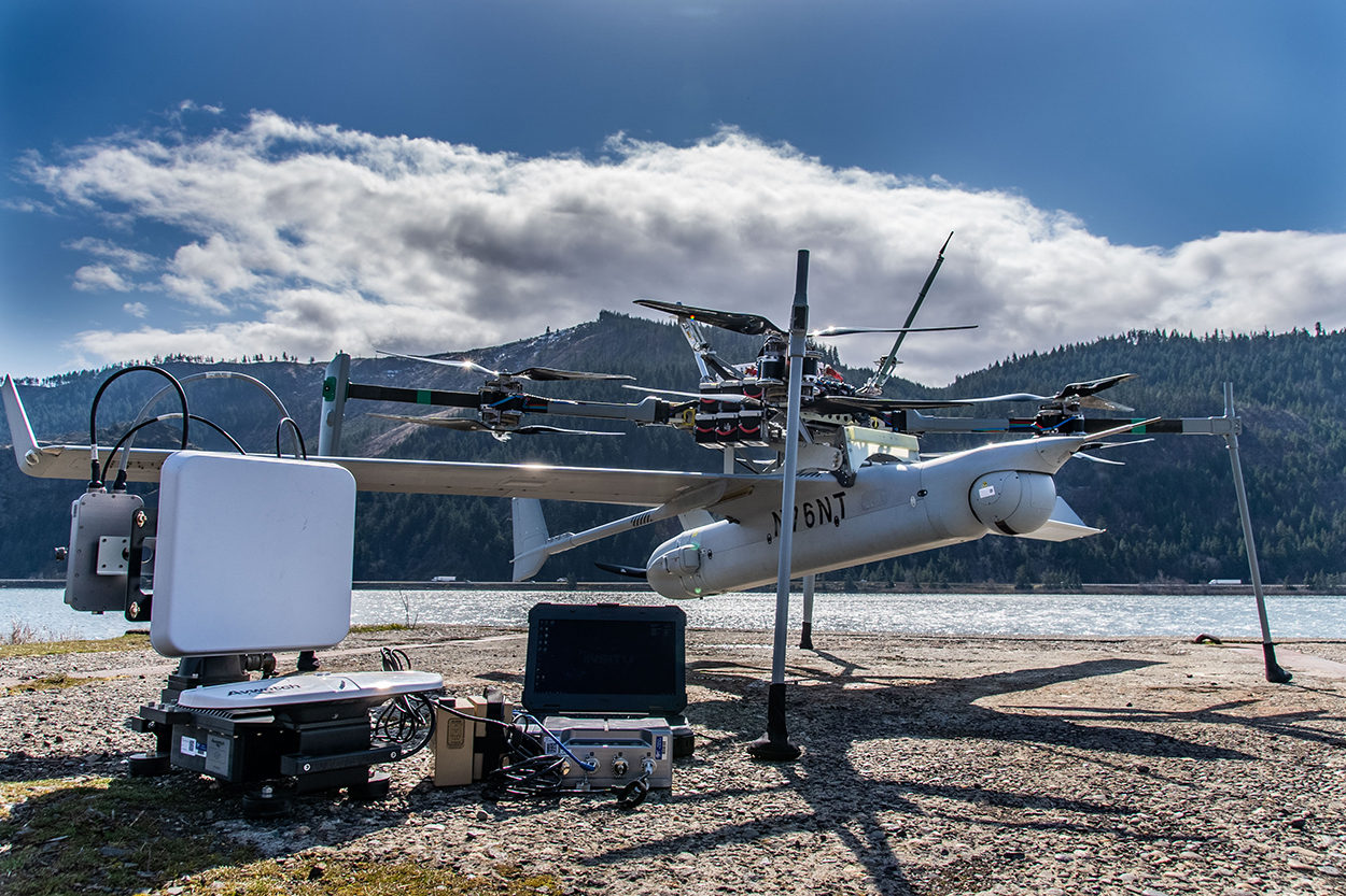
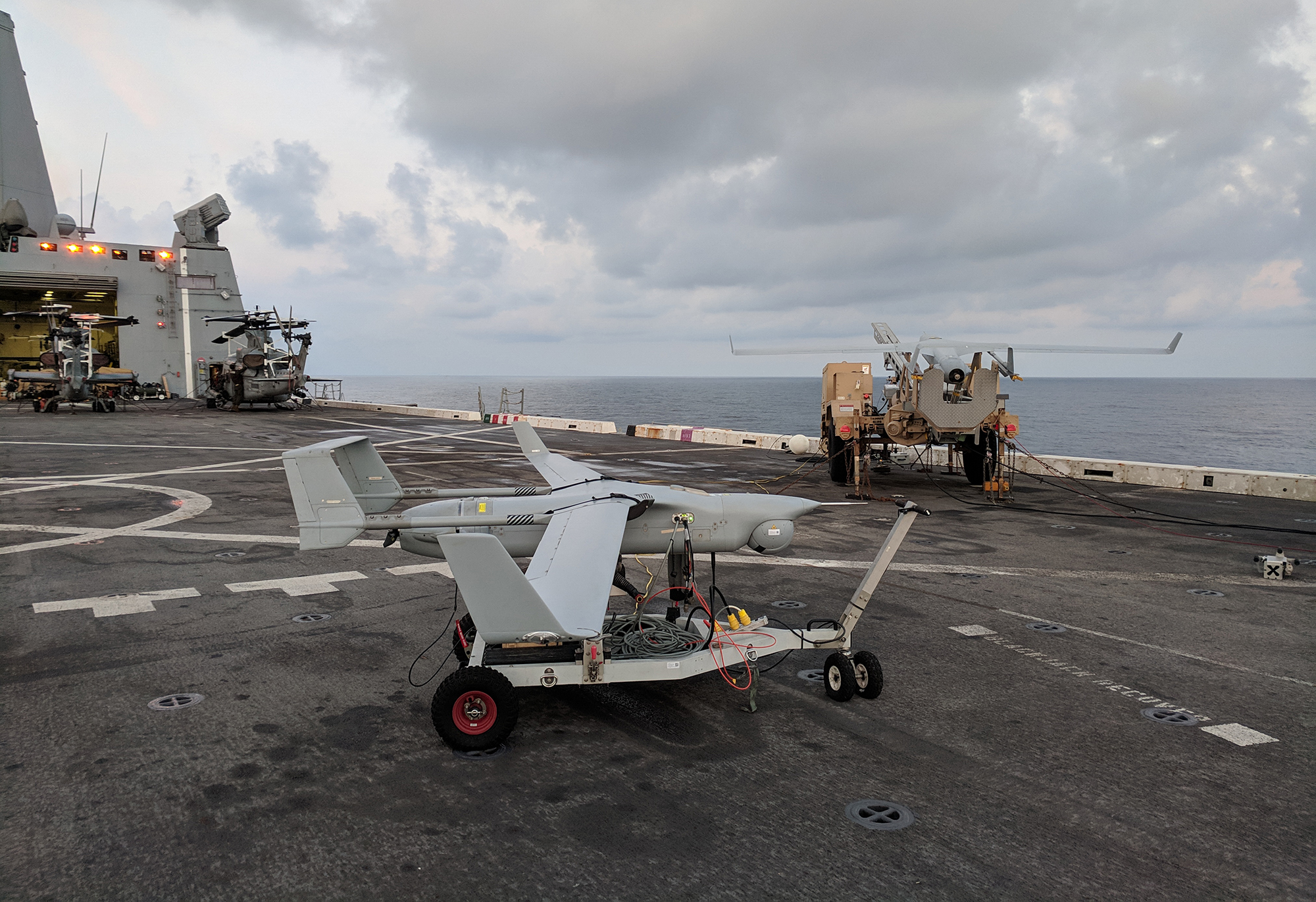
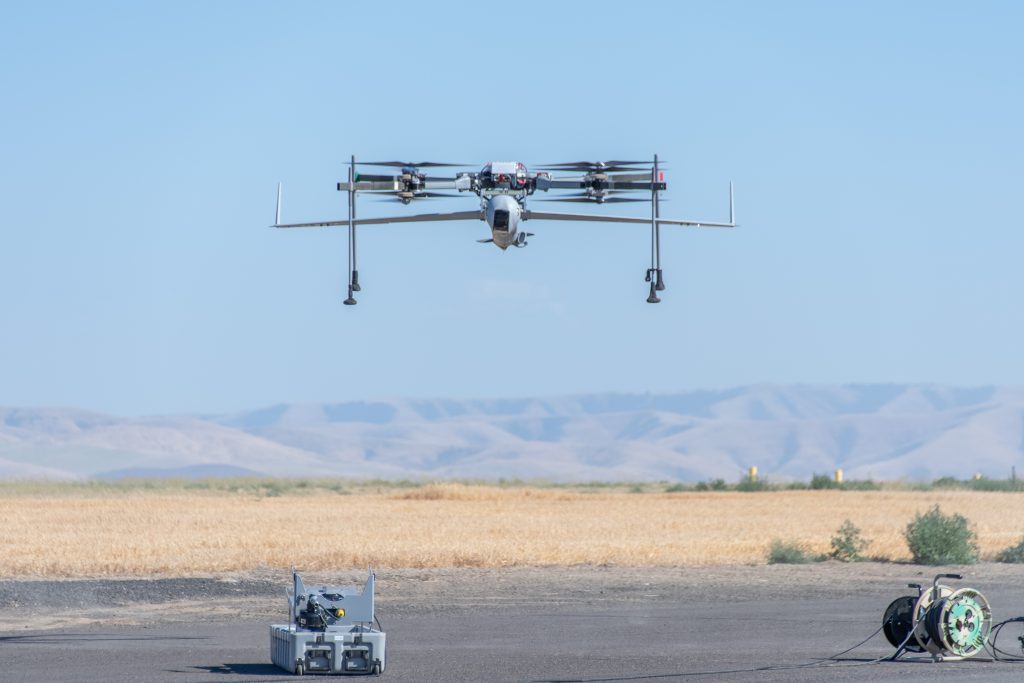
ScanEagle is available with both traditional rail launch/Skyhook and FLARES Vertical Take-off and Landing kit. VTOL requires minimal deck space and zero aircraft modifications. Ready to launch within 30 minutes with only 2 operators.
Resilient Autonomy
ScanEagle has been operating in GPS-contested and denied environments since 2018. Alt-nav, resilient datalinks, and other advanced resilience features onboard.
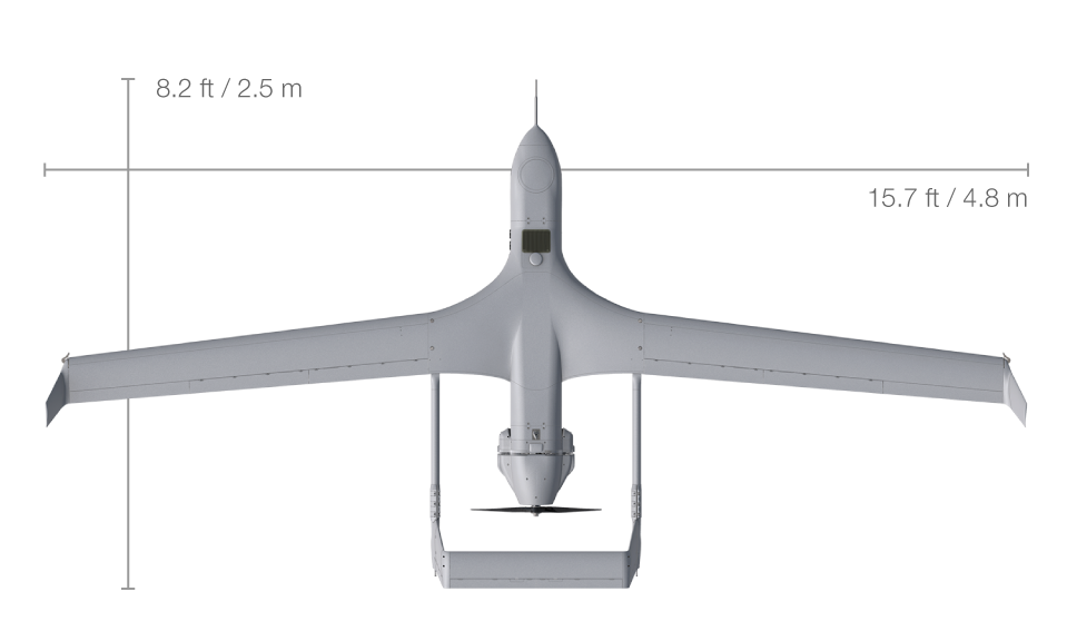
ScanEagle Specifications
Size and Weight
- Max takeoff weight: 62 lb / 28 kg
- Max payload weight: 17 lb / 8 kg
- Payload power: up to 150 W
- Length: 5.6ft / 1.71m
- Wingspan: 10.2 ft / 3.1 m
Performance
- Endurance: 18 hours
- Ceiling: 19,500 ft / 5,950 m
- Max horizontal speed: 80 knots / 41.2 m/s
- Engine: Heavy fuel (JP-5 or JP 8) or C-10 gasoline engine
SATCOM C2
- Proliferated Low-Earth Orbit Constellations SATCOM available
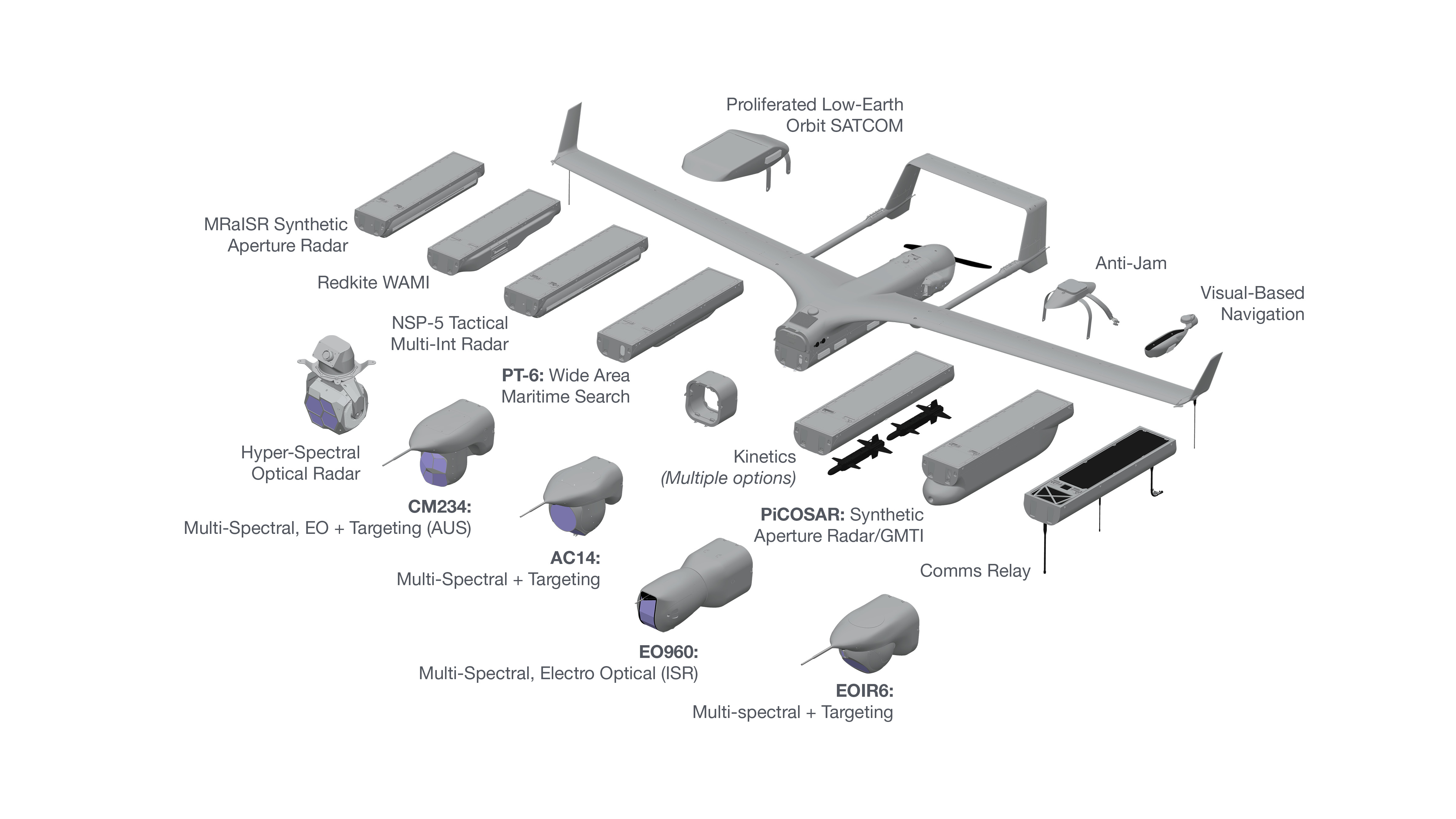
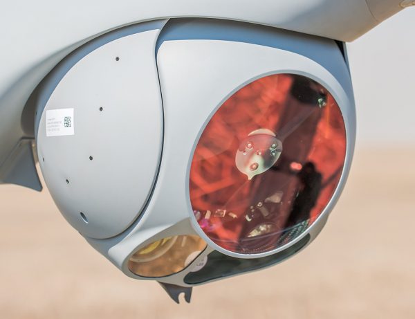
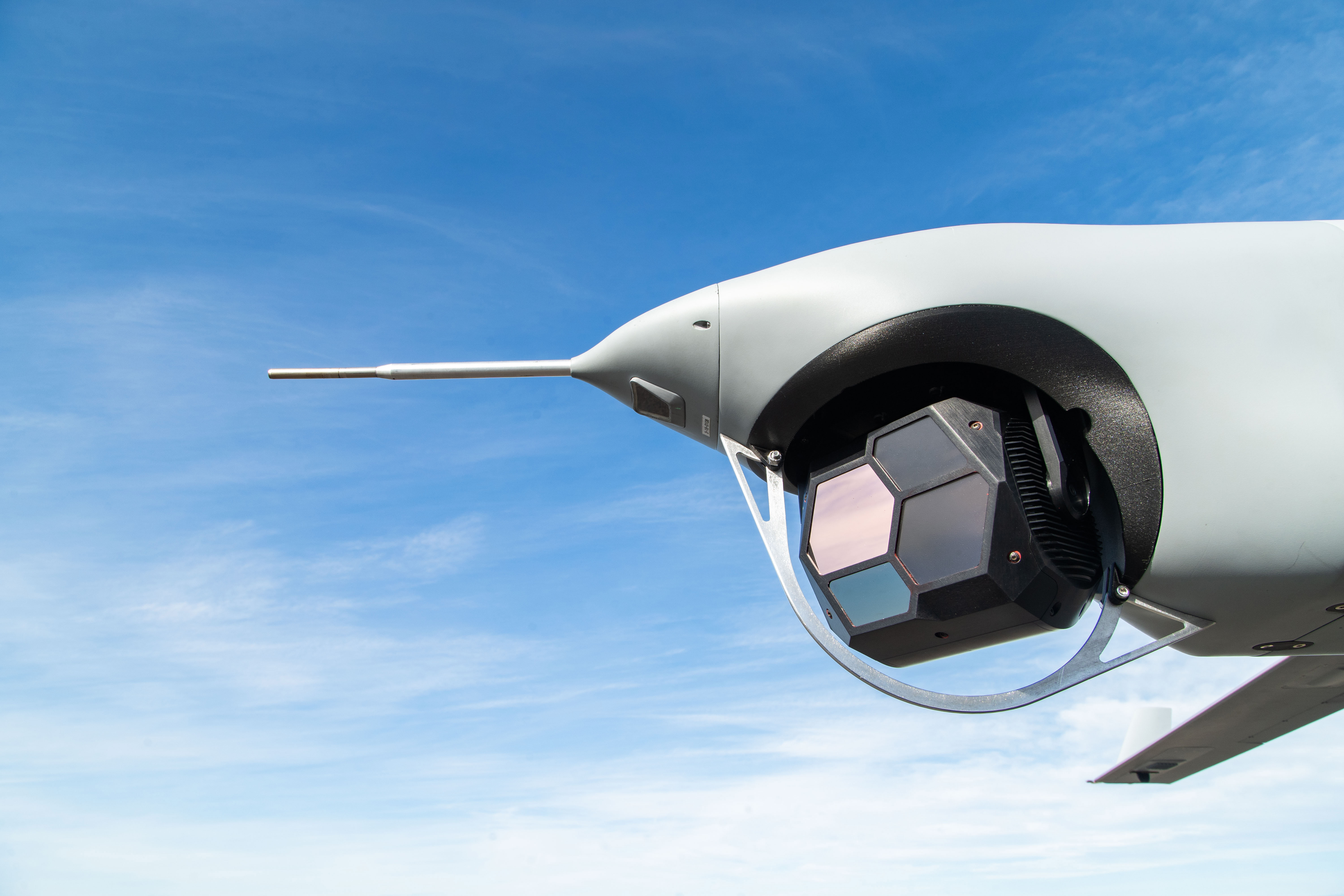
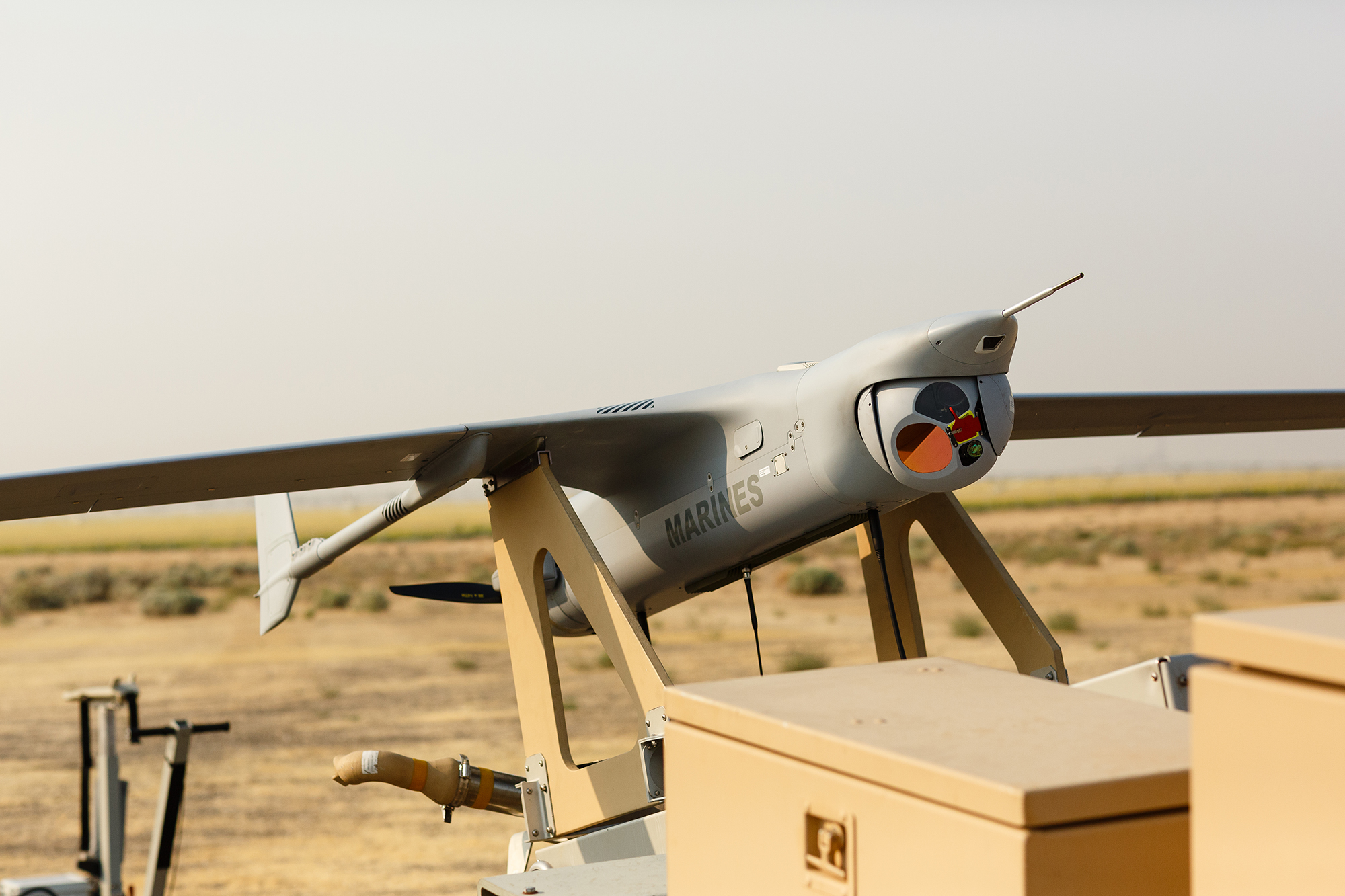
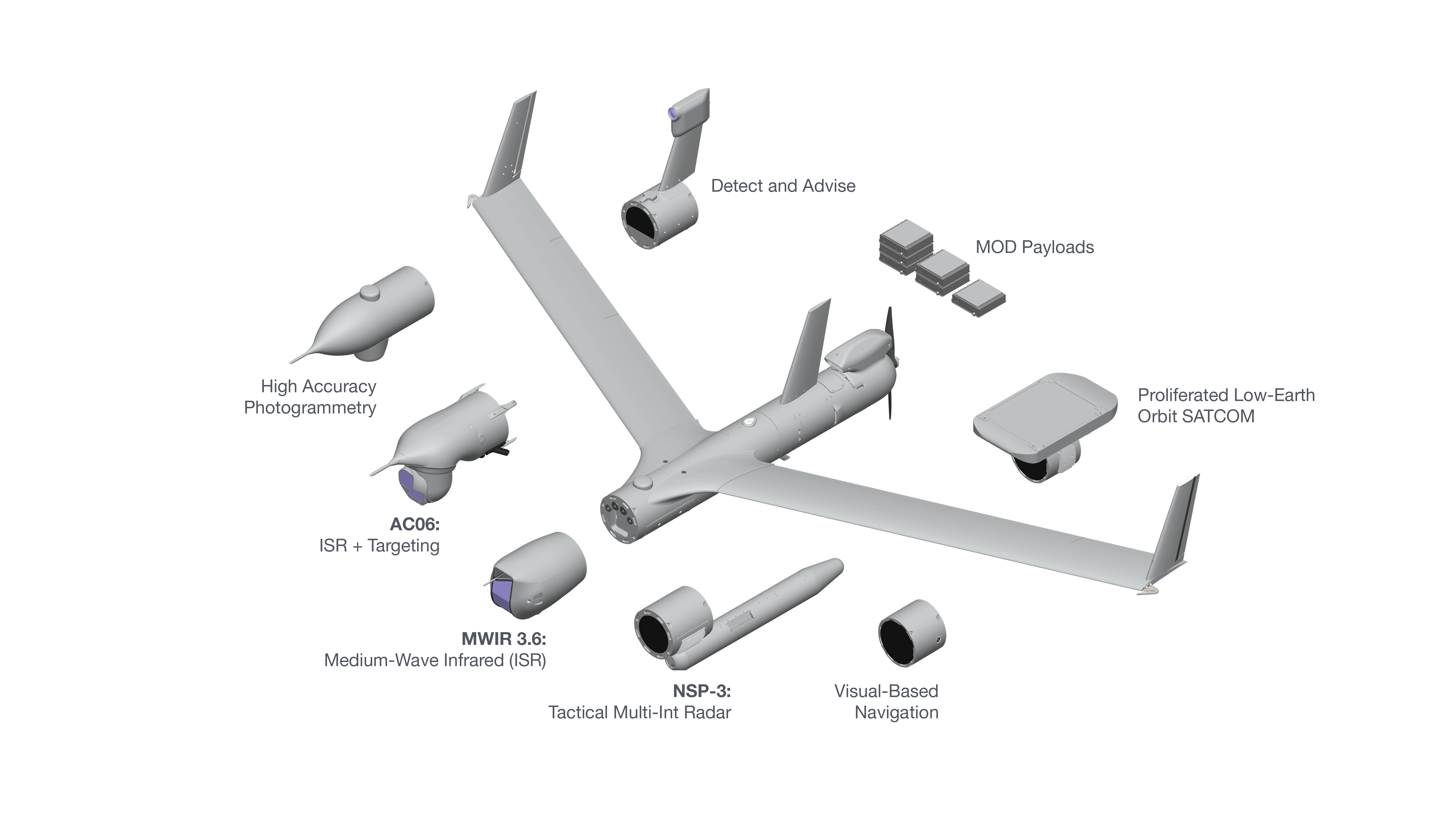
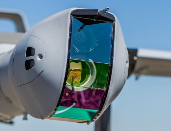
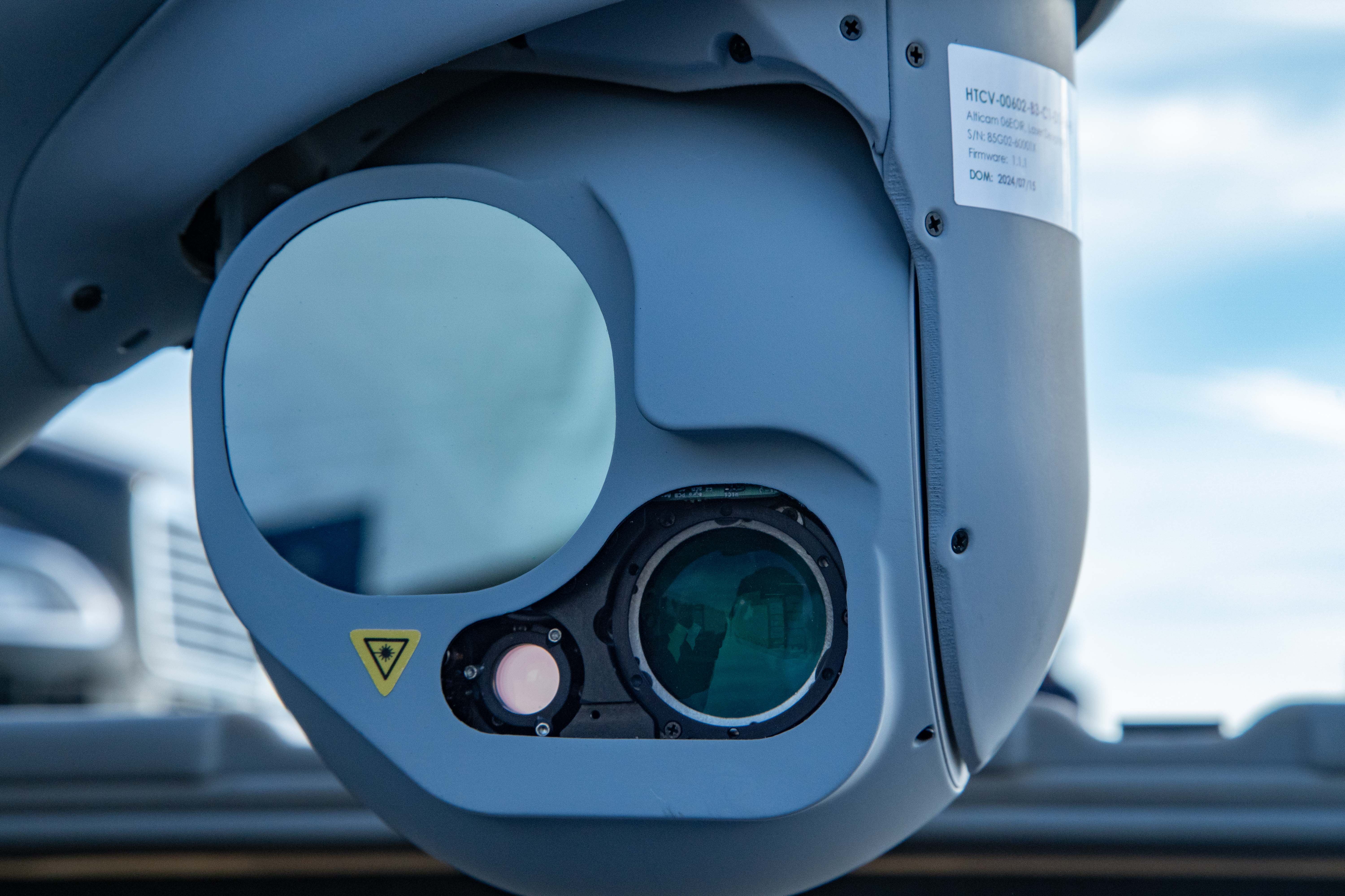
Sensor and Data Options
- Electro-optical (EO) camera and telescope
- Medium-wave infrared and EO for day-to-night operations
- AI-assisted wide-area maritime search
- Synthetic Aperture Radar (SAR): MMTI/GMTI, CCD
- Laser range finder, laser pointer, and laser designator options
- Electronic warfare / SIGINT / comms relay
- AIS: Maritime vessel identification
- Visual-Based Navigation
- Detect and Advise
- Video Datalink: Analog, digital encrypted
- C2 Datalink: Encrypted, unencrypted
FLARES Specifications
Weight
- Max ScanEagle weight 62 lb (28 kg)
Temperature Range
- -20º to +45º C
Wind Range
- 0-30 knots
- 10 knot gusts
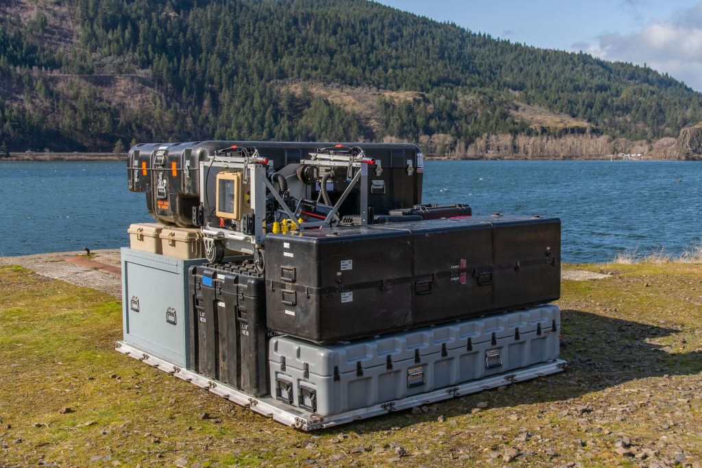
Full Mission Set Packout
- 463L pallet: 108 x 88 x 62 in
(2.74 x 2.24 x 1.57 m)
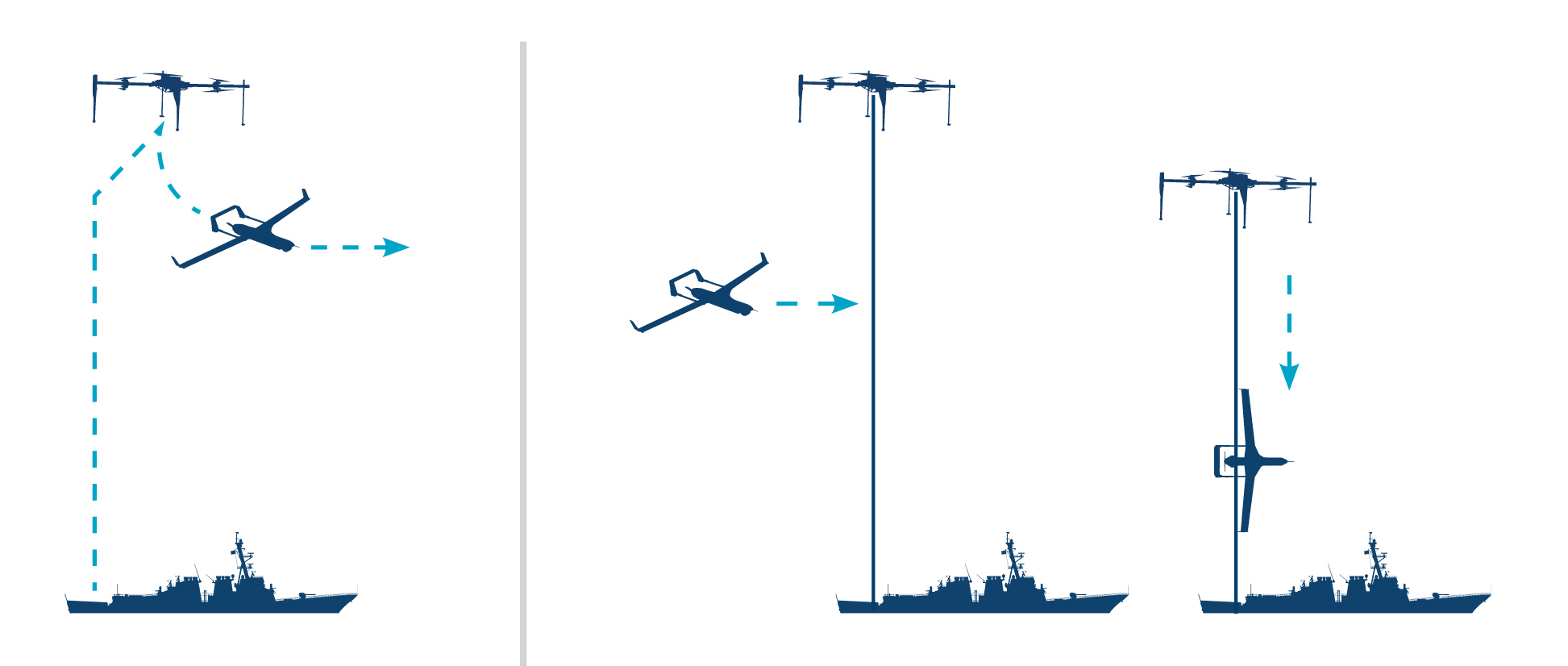
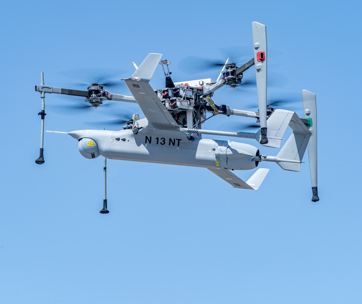
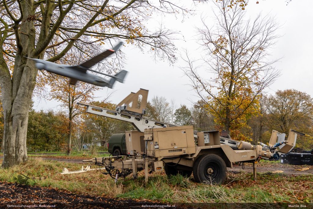
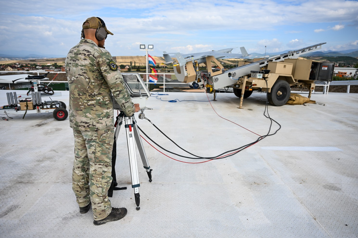
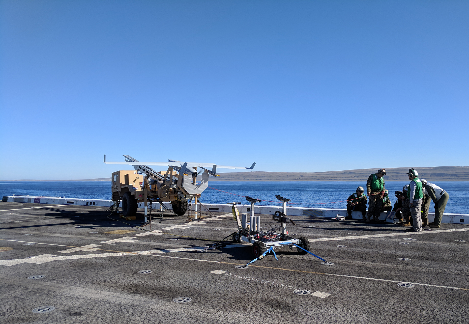
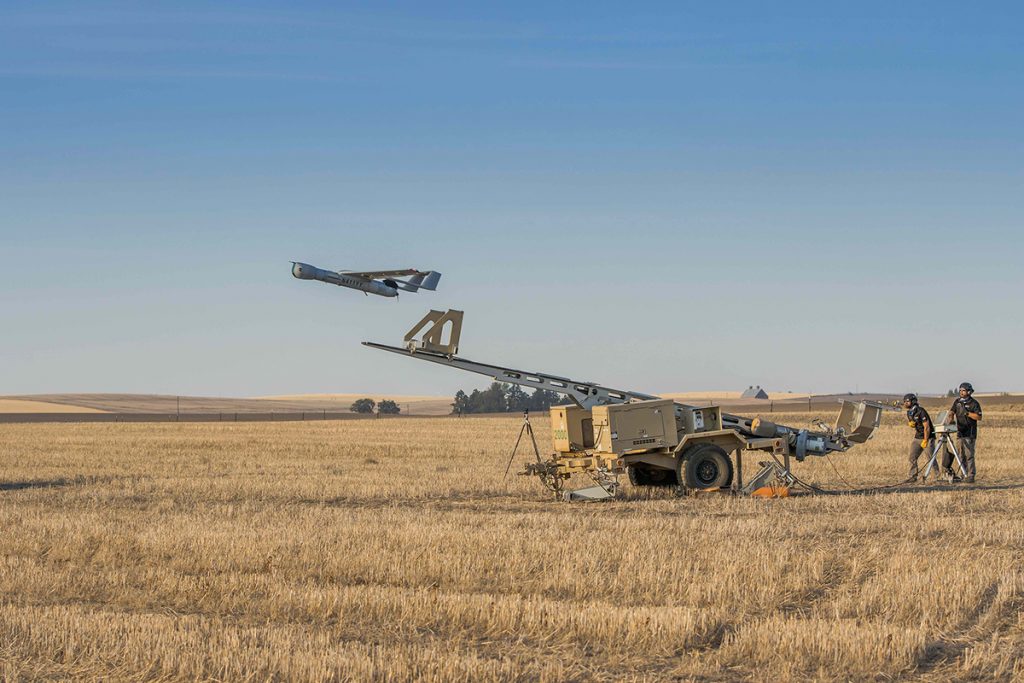
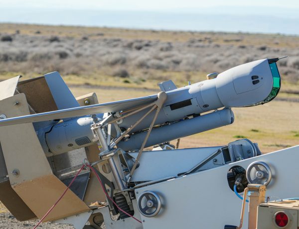
How does ScanEagle with VTOL work?
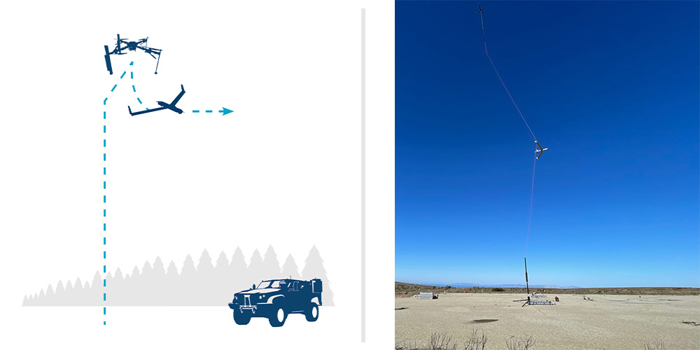
LAUNCH
FLARES mated with ScanEagle climbs vertically to altitude (500′ AGL), dashes into the wind, and releases ScanEagle into fixed-wing flight (<5 minutes).
- FLARES returns to land/ship launch point
- In case of an aborted launch, FLARES returns and lands vertically with ScanEagle still attached.
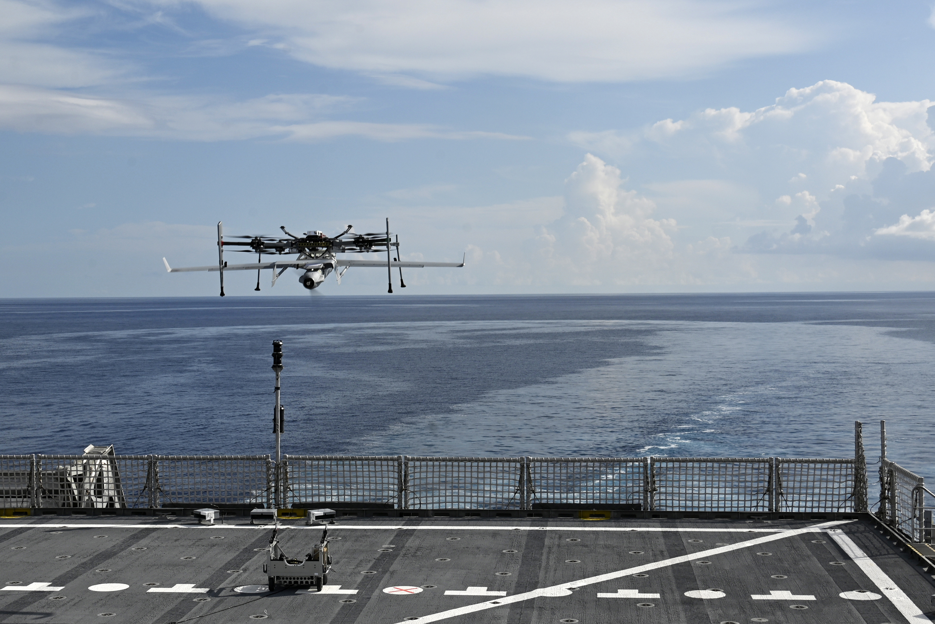
RECOVERY
FLARES takes off vertically tethered, hosting capture rope into the air (~300′). ScanEagle catches on vertical line via wing hook (<5 min)
- FLARES descends as the capture rope is wheeled onto the winch in MARS (Mast Augmented Recovery System) and ScanEagle settles onto the top of the mast.
- Unloaded FLARES lands.
Ready for Battle Management Systems
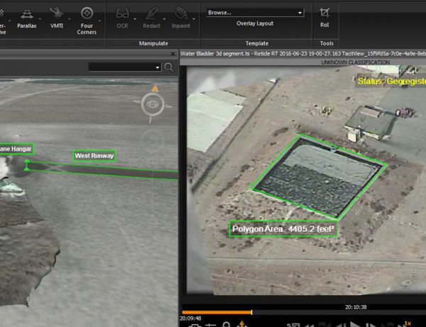
ScanEagle’s open architecture enables rapid integration with third‑party mission and battle‑management systems. Onboard autonomy includes automatic target recognition trained on decades of computer vision expertise, detect and advise, and other capabilities designed for one-to-many UAS operations.
Resilient in the Harshest Environments
ScanEagle delivers next-generation survivability for today’s and tomorrow’s contested, denied, and degraded airspace with autonomous and visual navigation, GPS-jam resilient guidance, adaptive RF switching, weather avoidance, and automated airspace safety (including DAA).
Game-Changing Range, Endurance, and Capacity
ScanEagle delivers 18+ hours of endurance, 17 lb payload capacity, and over-the-horizon SATCOM for persistent detection, classification, tracking, and targeting. Its VTOL kit enables expeditionary operations without sacrificing range, payload capacity, or power.
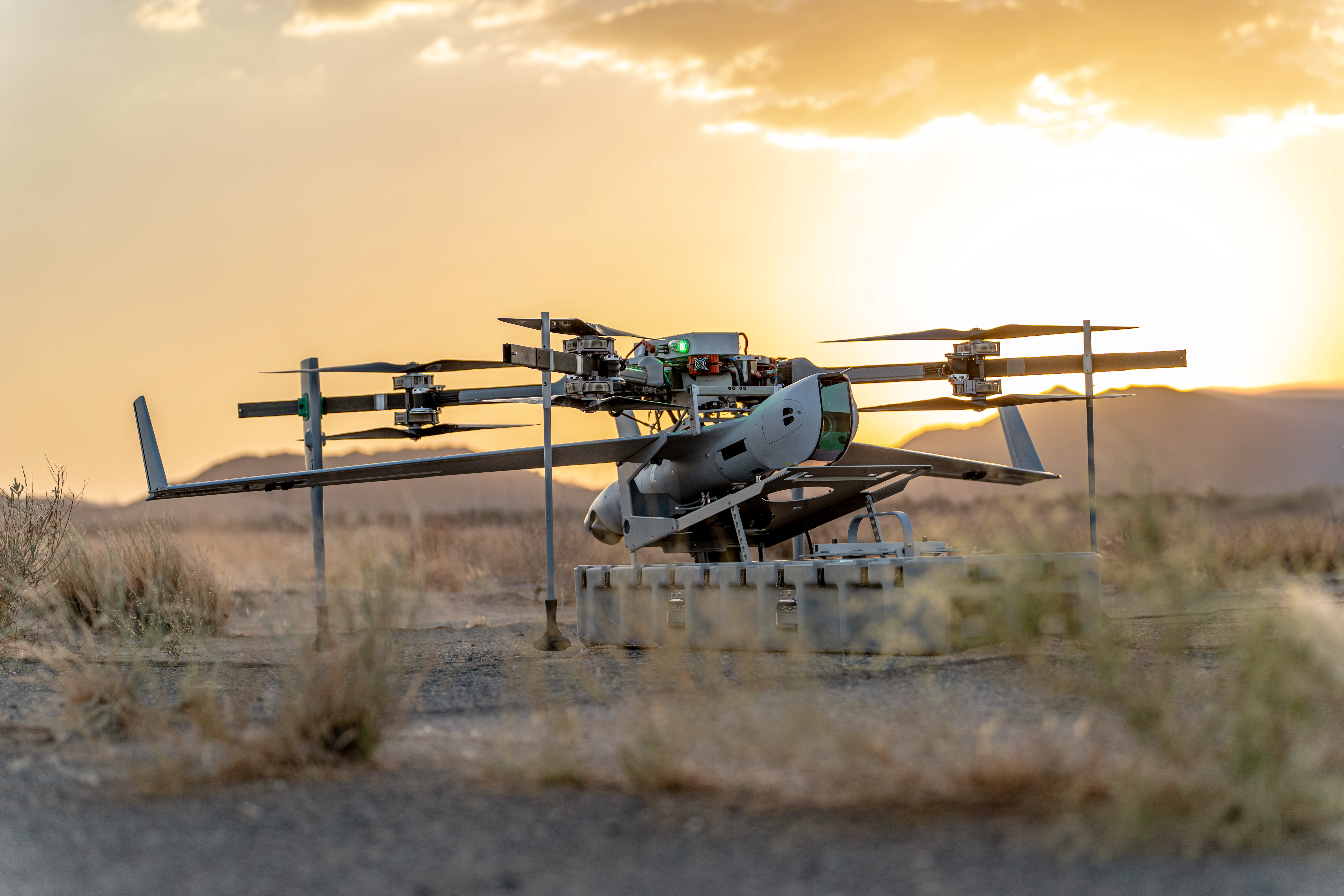
Flexible Operations From Front Lines or Rear Positions
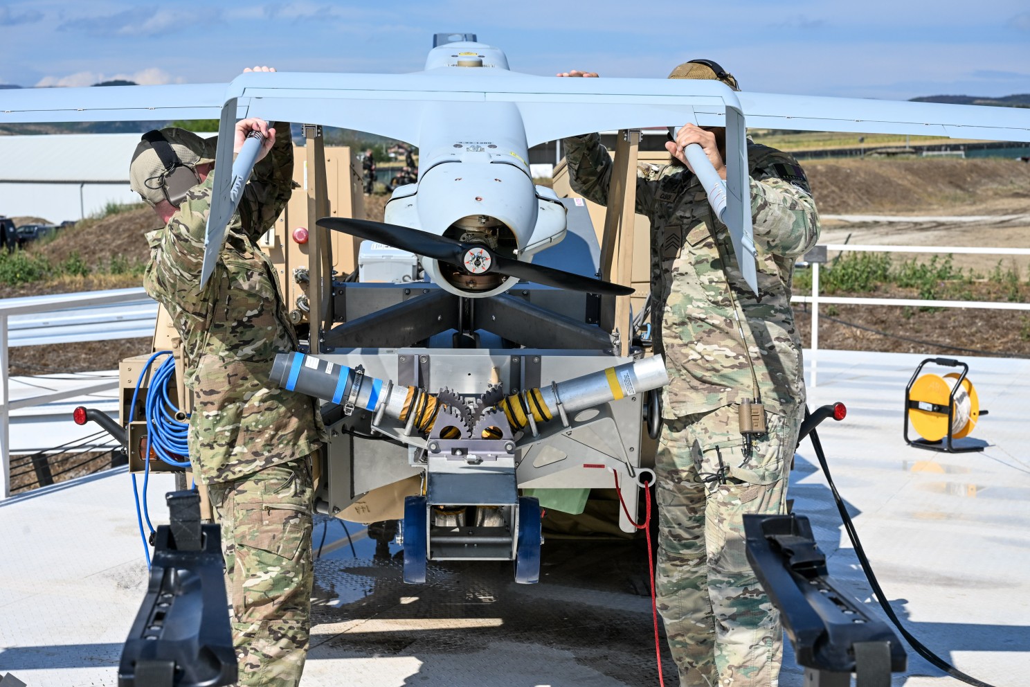
ScanEagle’s endurance, range, and flexible launch/recovery enable operations from almost anywhere. The FLARES VTOL kit supports expeditionary ops with a small packout, set up and launched in 30 minutes by two operators. Rail launcher and Skyhook deliver runway‑independent ops from forward or established sites – no aircraft modifications required.
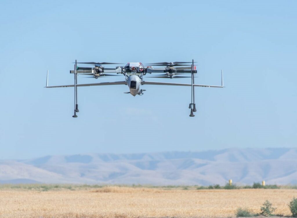

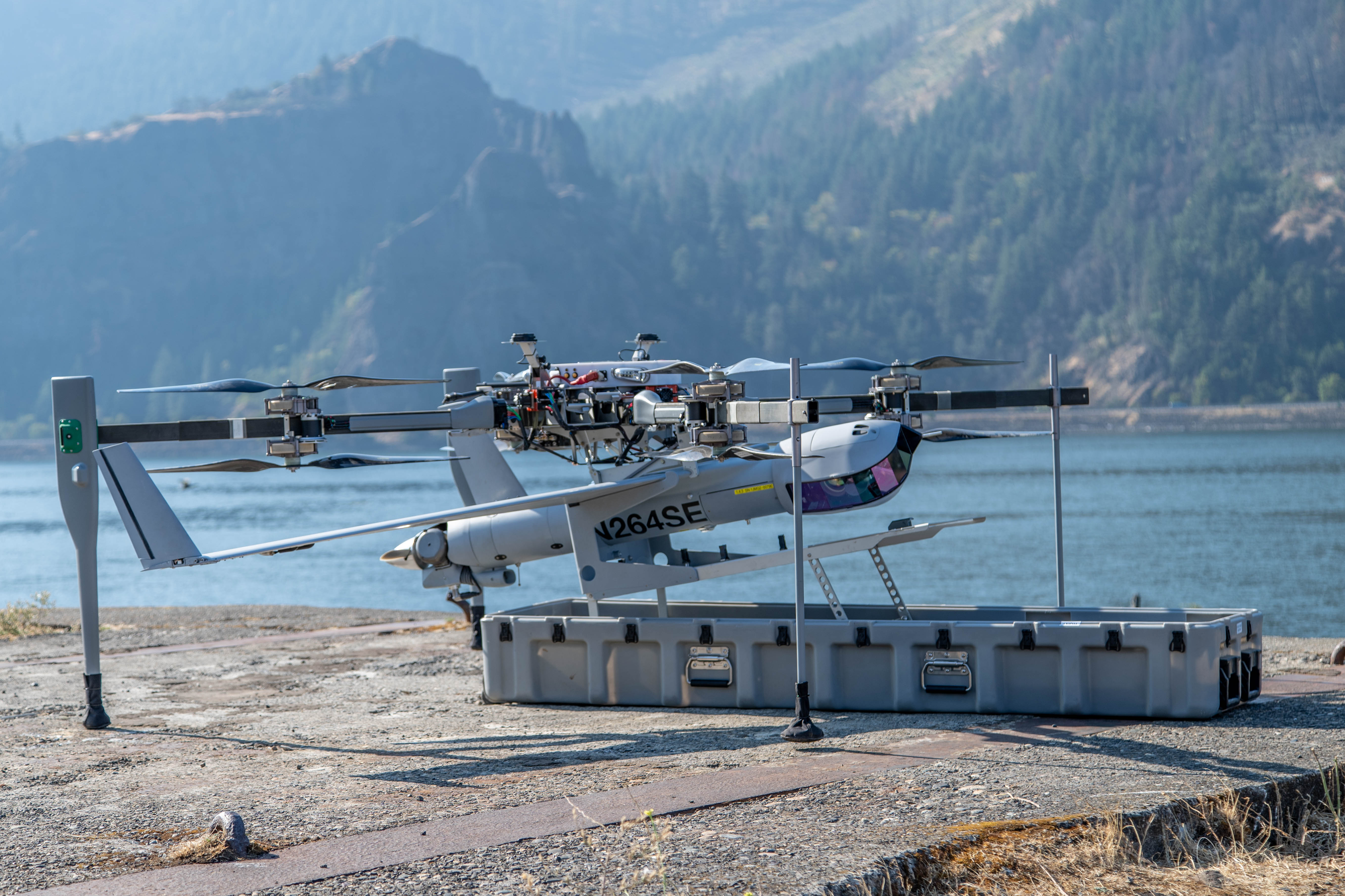
Ultimate VTOL Portability and Self-Sufficiency
FLARES VTOL kit enables rapid repositioning and tight‑space ops on land or at sea. Its small, transportable footprint supports island‑hopping, ship‑to‑shore, and other point‑to‑point missions, and it’s available to current ScanEagle users with no aircraft modifications.
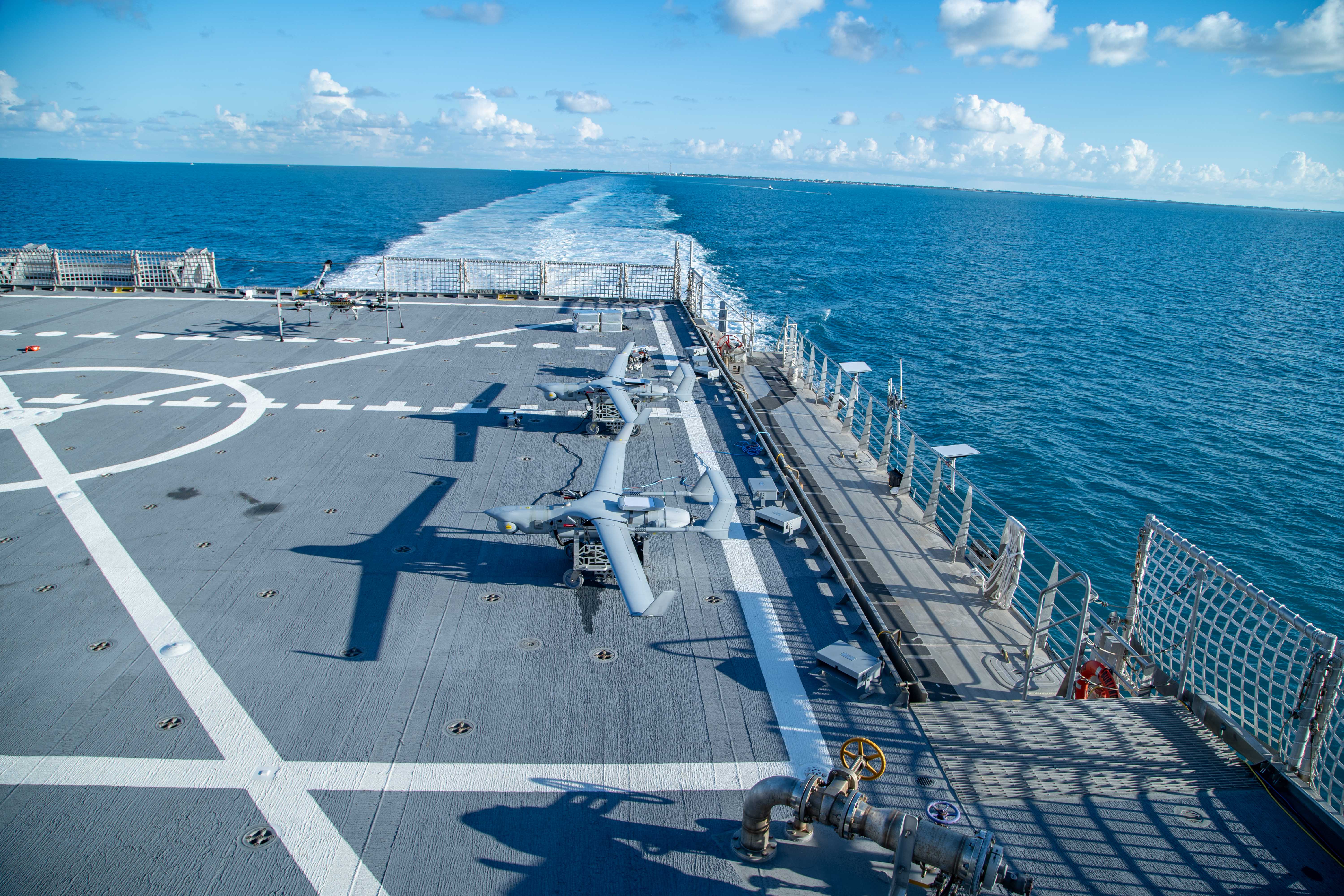
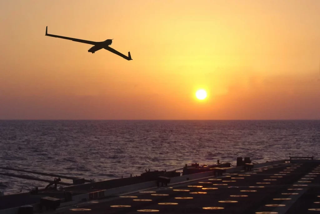
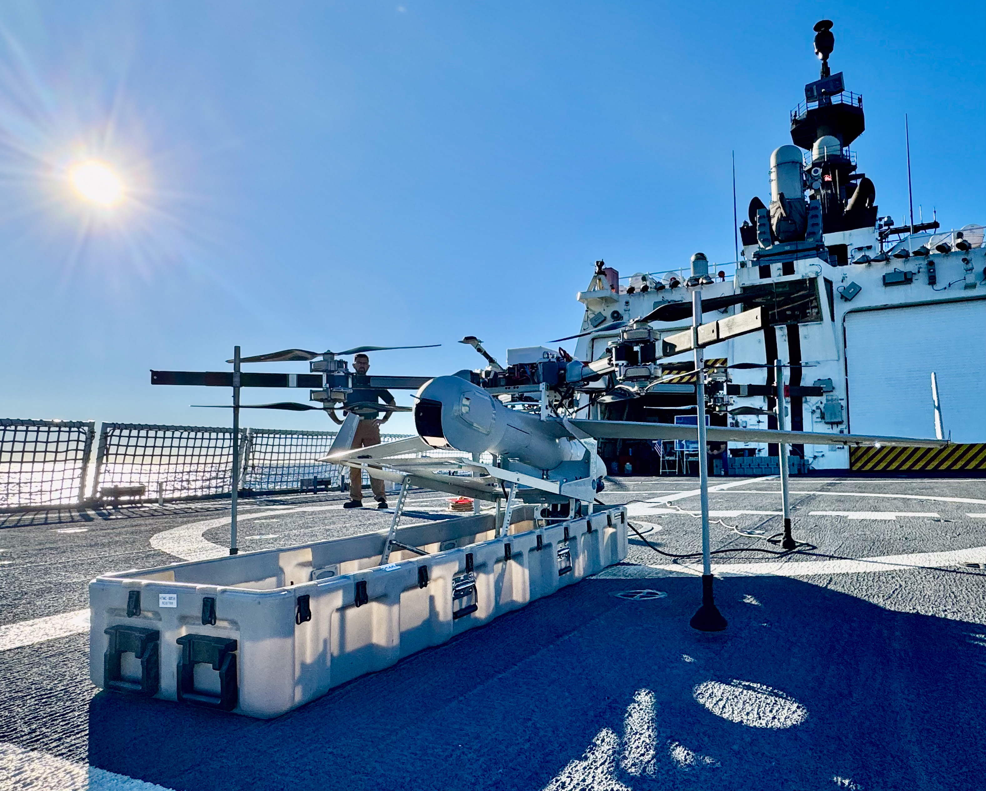
Optimized for Challenging Shipboard Operation
Born from decades of maritime ops, ScanEagle with the FLARES VTOL kit is hardened for heavy seas, high winds, and tight shipboard spaces, launching from small‑vessel helicopter decks even in high pitch and roll.
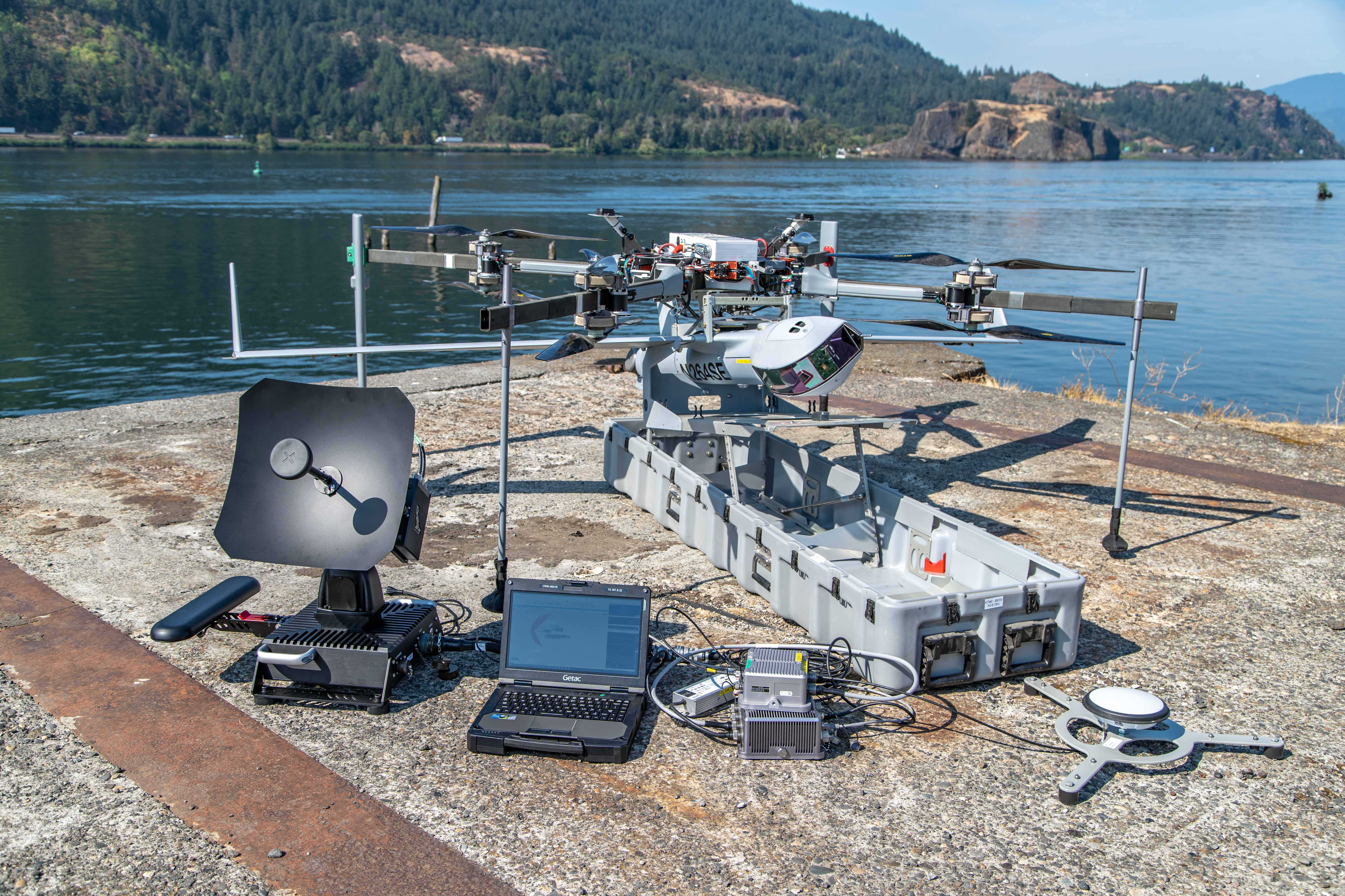
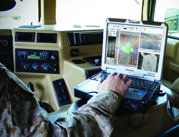
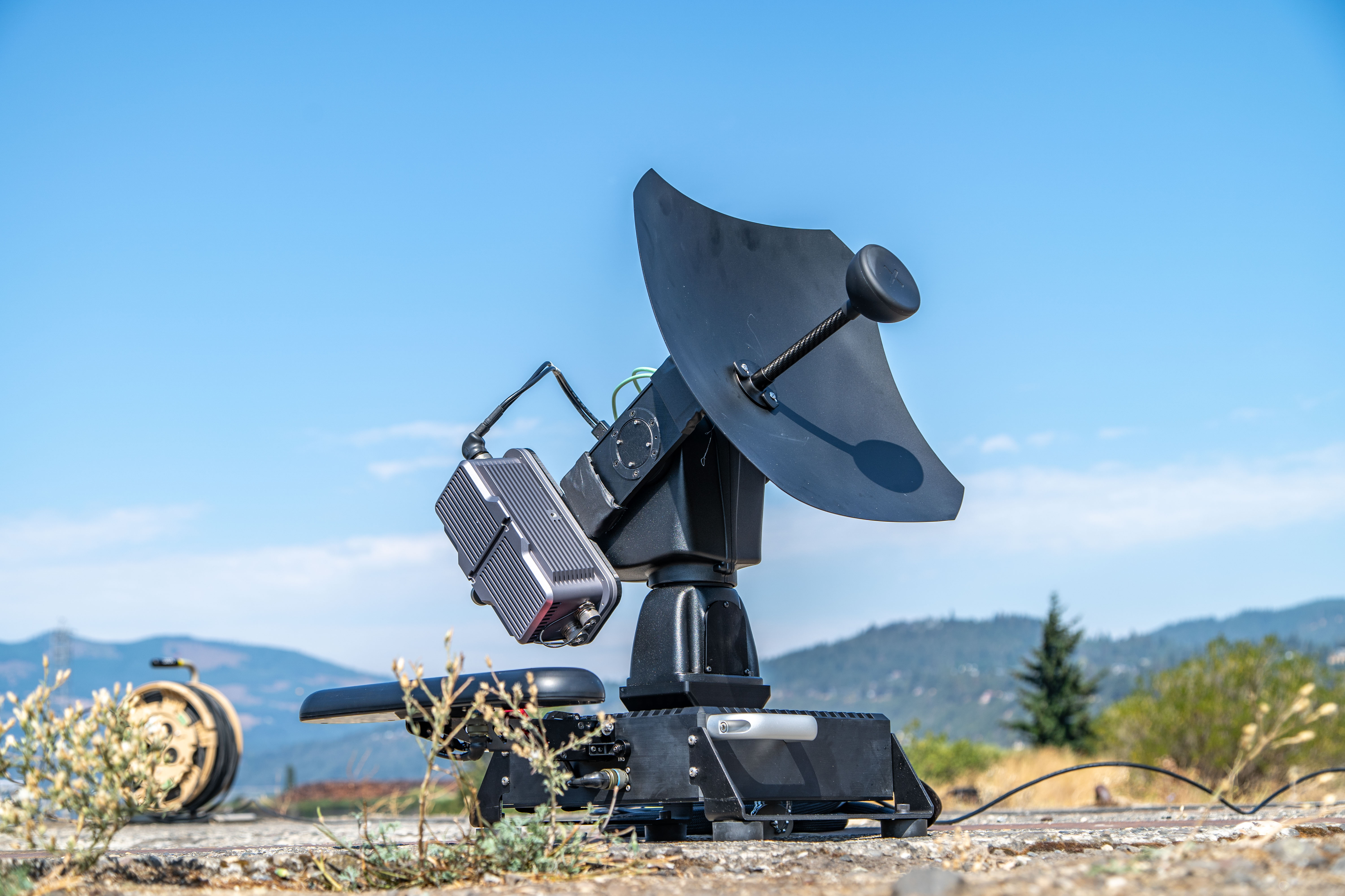
Truly Interoperable with Common Ground Control Station
Insitu’s compact, modular cGCS minimizes footprint and maximizes interoperability. Configurable for vehicle, land, or shipboard use, it supports SATCOM, LOS control, and non‑Insitu UxVs.
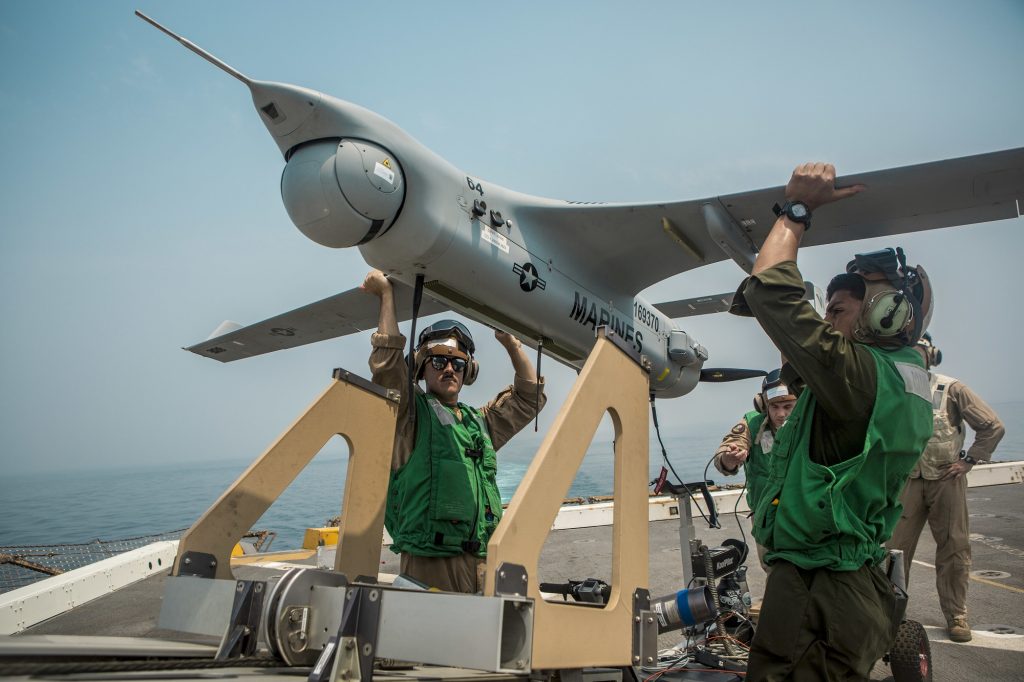
Trusted Performance
With 1.5M+ combat operational hours and continuous land and maritime deployments since 2004, ScanEagle is battle‑proven with U.S. and international forces in harsh, contested environments.
Ready for Joint Operations
Compliant with relevant NATO and industry standards to allow interoperability across joint, coalition, and allied forces.
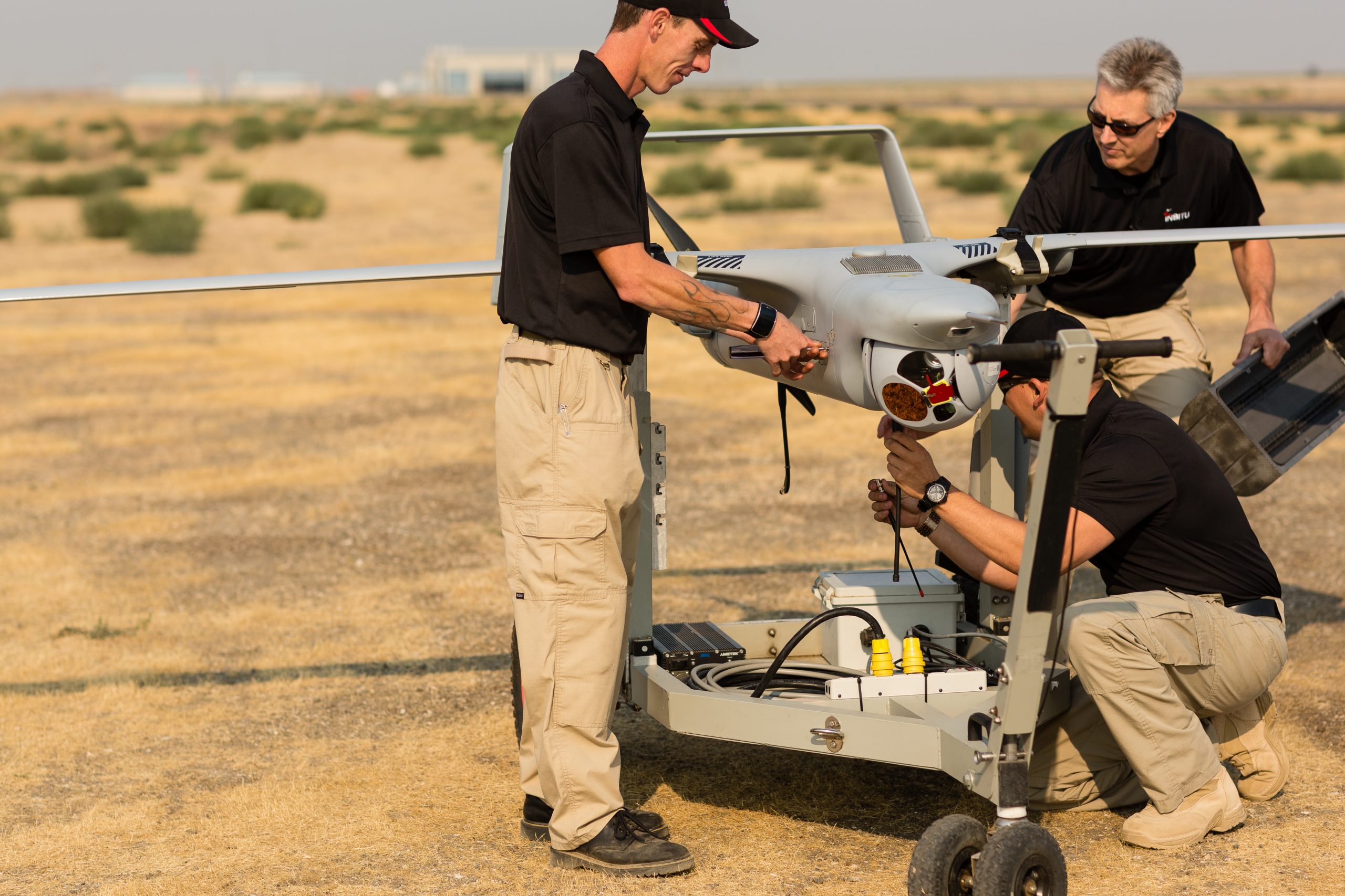
Payload Flexibility
Field-swappable payloads can be rapidly reconfigured to support a wide range of missions—electronic warfare, ISR, comms relay, overwatch and targeting.

Ready to learn more?
Related Systems
Operate ScanEagle VTOL with these configurable payloads.
Common Ground Control Station (cGCS)
In the News
Related Stories
Insitu Introduces PLEO SATCOM for ScanEagle UAS
These enhancements position ScanEagle as the premier choice for reliable over-the-horizon Beyond Line of Sight (BLOS) Intelligence, Surveillance, Reconnaissance and Targeting (ISR-T) missions
Read More »Insitu Launches Autonomy Centre of Excellence in Oxford, UK
Insitu announced the establishment of its new Autonomy Centre of Excellence in Oxford, UK, solidifying the company’s long-standing commitment to advancing practical autonomy and artificial intelligence (AI) solutions critical to the future of global defence.
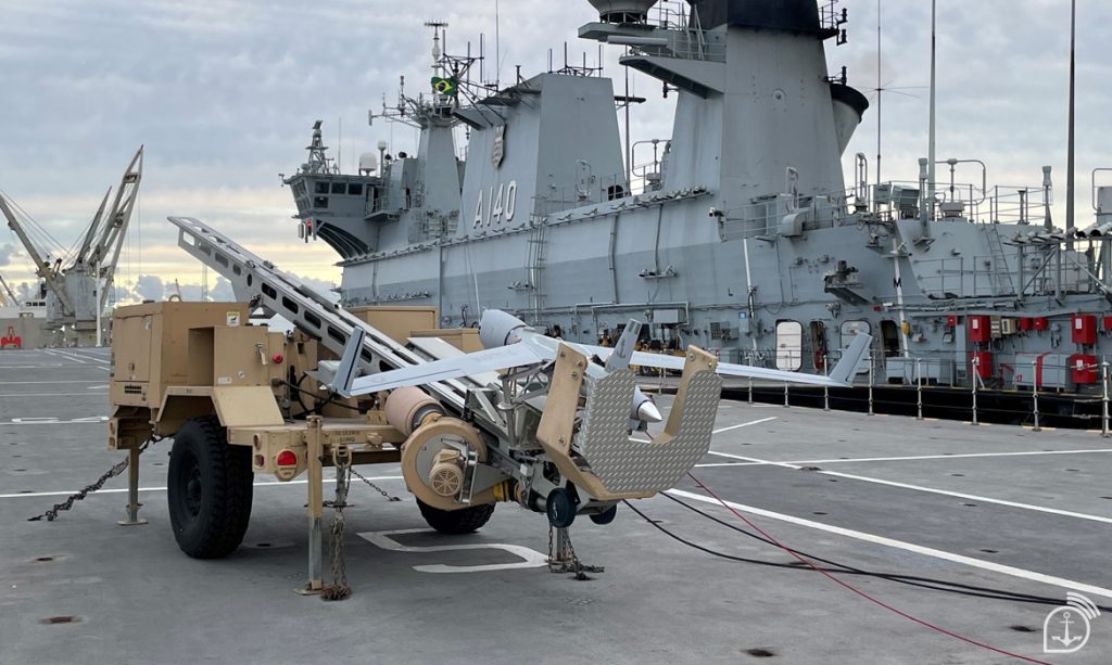
Read More »Brazilian Navy deploys ‘ScanEagle’ and NPA ‘Babitonga’ in exercise
The training included the participation of the Patrol Vessel “Babitonga” and the remotely piloted aircraft RQ-1 “ScanEagle” , integrating monitoring, patrolling and support actions for joint operations with the Army and Air Force .
Read More »